After hiking Elephant rocks and eating our lunch in Farmington, we were ready for Pickle Springs. A park brochure describes it as "a trail approximately 2 miles long and will take you several hours to hike at a leisurely pace...moderately difficult with some short segments of steep grades". It is important to take it slow, if for no other reason then to appreciate the beauty of its canyons, ravines, waterfalls and tall sandstone bluffs.
First natural area which we came to is called The Slot. It began forming when shifts in the earth's crust caused vertical fractures in the limestone.
The walls of this ravine are peppered with strange holes, pockets and ridges, and is constantly being eroded by freezing and thawing.
Amanda, our son Dan's wife is showing the double arch in the picture above. It is one of the more fascinating features of the park.The buttress arch supports three huge rocks, two of which form another smaller arch.
Pictured above is the Keyhole, another type of arch, formed by two very large rocks leaning against each other.
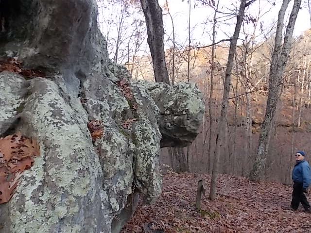
And above we have the Terrapin Rock. Surely you can see what looks like a turtle head in the picture above? From here the trail slopes downward into the Pickle Creek area.
It was a bright sunny day, but some how my camera did a poor job in picking up the colors around the creek and small waterfalls of Pickle Creek. In this area the vegetation was quite lush with moss and ferns, shades of green strikingly beautiful against the rock walls of Spirit and Rockpile Canyon.
Some of our hiking group (nieces Rebecca and Elizabeth) joined us for this hike on Tuesday afternoon. They are pictured standing on Dome Rock Overlook, one of the largest hoodoo complex in this natural area. I certainly hope by now I have piqued your interest to visit what we consider one of the more beautiful parks in Missouri!


No comments:
Post a Comment