John and I were more than ready for some time away from St.Louis, having made no long distance trips during the summer. We started thinking that a train trip would be fun again, and there was a direct Amtrak route from Carbondale, Illinois to New Orleans. My sister Linda lives in NOLA, which was the main reason we picked that city. Only problem with that idea was that we would have to leave downtown St.Louis by bus (provided by Amtrak) at 11pm to get to Carbondale by 1AM to board the train. Not the best of circumstances, but we did it and survived. The train was full of passengers coming back, and spending the night hours sleeping upright in a coach seat is not conducive to sleep. And what a big disappointment to learn that Amtrak no longer has a dining car! Just on a few routes out west.

Our hotel was near the French Quarter of New Orleans. Once we had checked in and started walking to find our supper, I glanced up and noted the palm trees. It was like being in Florida again, and, unlike up north at this time of the year,, we could again don shorts, tees and sandals on our feet. After a wonderful seafood supper in the French Quarter, my sister Linda (who was so kind to meet us at the train station) guided us several blocks over from the restaurant to board the trolley to her church for our evening entertainment. It was her recommendation that we not rent a car for the weekend we would be there, because in NOLA parking is bad. So we walked a great deal and/or boarded a trolley- not bad at all and safe despite the multitudes using the trolley with us. Friday evening we heard a wonderful jazz concert. Bethlehem church was using the concert to raise money for their affordable housing fund. They have already built one house for two families and plan to build three more. The church also provides food for over 100 people several days a week- by now it may be more than that as other institutions are helping them with that. I have to give a big shout out of thanks to that church and wish them continued success in caring for the less fortunate.

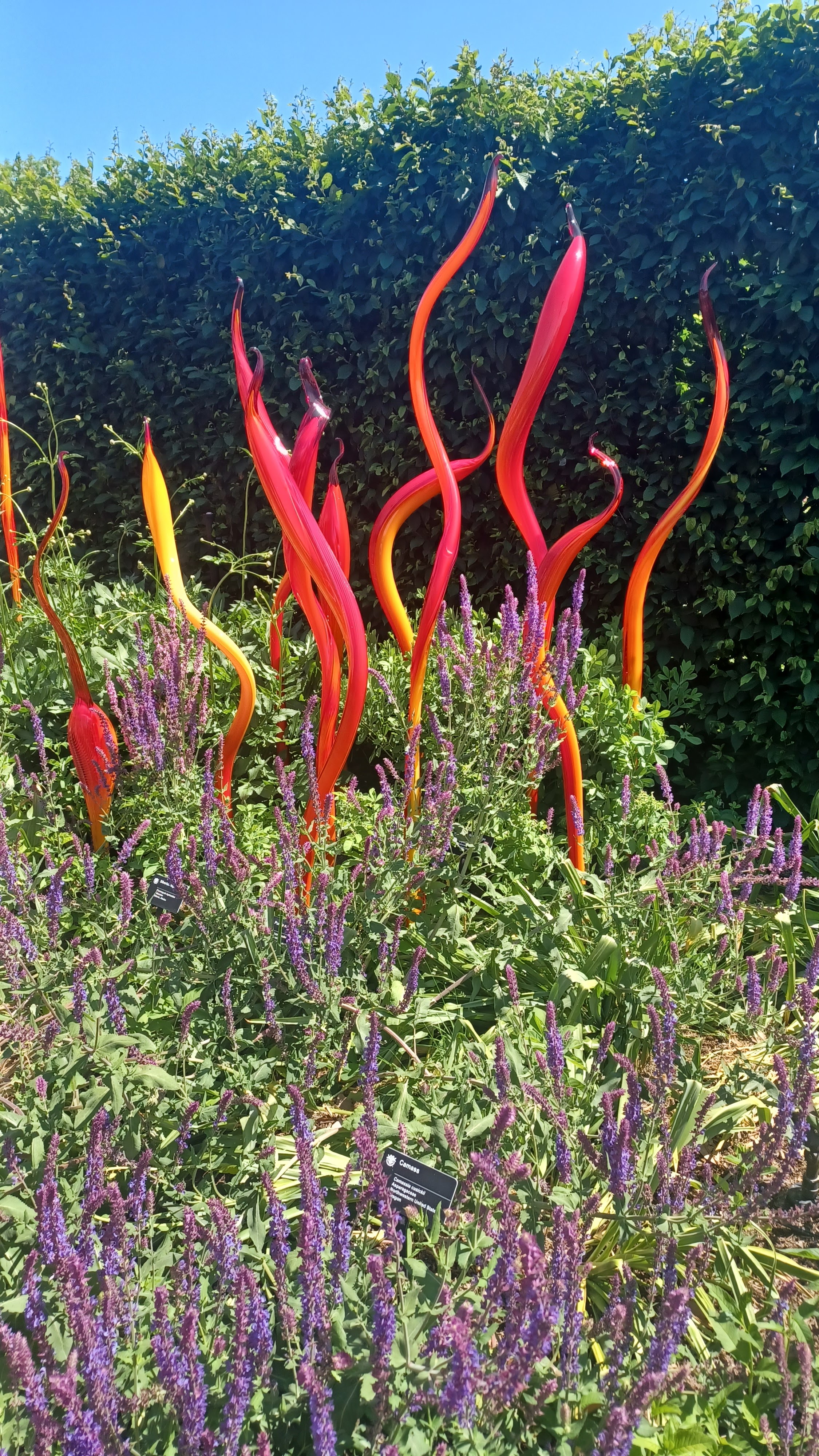
And on that note, pictured above is a sculpture we saw the next day at the Besthoff Sculpture Garden. Our niece Kat drove us to this garden, which is near the New Orleans Museum of Art. The title of this sculpture is "Together We Stand". The information sign by it says that George Rodrique was the artist- and there was a date of 2005. That was when Hurricane Katrina hit New Orleans very hard, breaking its levees and flood walls; some neighborhoods had water as high as 10feet deep.
At the time when we were in New Orleans we were a week away from Halloween, so the above spider sculpture caught my eye. Very appropriately placed under a live oak and hauntingly draped with Spanish moss! We saw many more sculptures in this garden, but I must move on to other points of interest which we saw in our short time in NOLA.
Pictured above is another live oak- but this one in particular is historical. It is called the Dueling Tree. Back in the day when feuds were settled by sword or pistol, this was the spot where the quarreling men chose to meet and fight each other. Needless to say, it is a very old oak tree.
.
We found this interesting monument in Crescent Park, which is located along the Mississippi River. It was built in thanks to the Latin American workers who helped rebuild New Orleans after the 2005 hurricane.
And this is typical New Orleans- a Halloween parade in the French Quarter, complete with floats and many costumed people. Beads and candy were thrown, and a constant smell of weed in the air!
Kat was also kind to drive us over to the areas of the city which had the most Halloween decorations, and we did see a few mansions which were very creatively decorated! Music was heard and dancing skeletons were seen in the windows of one of the homes. We also checked out some of the costume shops and I will leave you with one more picture so typical of NOLA.
.jpg)


.jpg)

.jpg)

 ,
,


.jpg)

.jpg)
.jpg)


.jpg)
.jpg)
.jpg)
.jpg)
.jpg)

.jpg)


.jpg)


