Wednesday, August 30, 2017

A Story of Resurrection

We left St.Louis, Missouri last Friday for Florida.  Our first night was spent outside of Nashville in the small town of Smyrna, Tennessee.  John just so happened to start reading the St.Louis newspaper of Thursday, specifically the entertainment section.  He was reading the movie reviews, one of which was regarding the movie All Saints.  He asked me whether we were in the town of Smyrna, which I confirmed that to be true.  "Well", he said, "the movie was produced here in Smyrna at the church of All Saints- let us drive by that church tomorrow before we head out of town".  The next morning, driving our big rig and towing a car, we set out in search of the church.  It was all a bit foolish to do, not knowing whether we would be driving some place where there would not be a spot large enough  to turn our home around!  We usually plan ahead better than that.
 
We had no reason to worry, the church's parking lot was quite large enough to accommodate our home and it was a very worth while stop.   Shortly after we arrived another car drove up to the church- a lady got out and introduced herself as Lisa Lehr.  She is the Christian Education leader of All Saints.  John and I were a bit familiar with the story of the church.  In 2007 Reverend Michael Spurlock accepted a call to All Saints, with the idea that he would be closing the church.  Same story as many churches- too few members and a mortgage they could not afford.  Shortly after he arrived the Karen tribe moved into the area.- immigrants from Burma.  They had attended Anglican services in Burma and were looking for an Episcopal church in America.  Soon attendance at All Saints swelled from about 25 members to over 100!  Lisa Lehr informed me that the church has continued to do well, it has a youth choir of 25 at present.
Pictured above is a myrtle tree, they are blooming presently- we saw lots of them traveling from Tennessee to Georgia.  In Atlanta we visited my sister Linda, and on Sunday we went with her to see the movie All Saints.  What an inspiring story, of how Pastor Spurlock and his church met the needs of the newly arrived immigrants and of how those people worked with the church hoping to pay off the mortgage.  Pictured below is the back of the church where there is now a playground, gazebo with a stone altar, and community garden.
 The story of two of the Karen is also particularly inspiring- Ye Win and Father Thomas Bu Christ.  God brought together many different people and circumstances to work out his destiny for All Saints.  It is also a cautionary tale for all churches not to close their doors but instead  to welcome strangers, refugees and immigrants.  Not surprisingly, there is always love to be shared all around.
 Lisa Lehr informed me that just this year a book has been published telling the story of All Saints.  She had one to sell me, and, as usually is the case, the book is so much better than the movie!  There is a lot more to the story than the movie portrays- many lives were personally impacted by the presence of the Karen in the community of Smyrna.  Most importantly,  many good souls started viewing their faith (or lack of it as the case may be) differently once they became involved with the needs of the church.  After I read the book I wished that we had taken time to step inside the church, and even walk around the grounds where crops were grown to help pay off the mortgage and feed the Karens- a place where many lives were changed.  Lisa had invited us into the church, but we felt that we had to be on our way.  As I said, I really regretted that decision after reading the book.

Wednesday, August 23, 2017

Eclipse 2017

It is interesting that I had a vague idea what the eclipse was all about, and what I knew (which was not much), I just thought was not all that much to get excited about.  How wrong I was, and am very glad that my husband John was insistent that we get back to Farmington Mo. to view it.  It turns out he was right, it was a wonderful experience not to be missed!
Hearing stories about what was seen of the eclipse, from partial to total, I must say we had one of the best spots in all of the 2,600 miles of its path.  In some areas it rained or was cloudy, other places the totality did not last that long.  We viewed it from our niece Miriam's backyard outside of Farmington.
The picture is looking to the south and toward the hills of the Ozarks.
So my one brilliant idea was to get before and after pictures.
Monday, or moon days s it became known, was a bright sunny day with very few clouds.  Around 11:30 AM we started watching the sun with our special glasses.  We could see that slowly the moon was covering the sun, like taking big bites out of it.  And the sun eventually disappeared.

Now my photography skills for this were quite bad, to say the least.  I was using my glasses to cover the lens of my camera, all the time trying not to look up into the sky toward at what my camera was pointed to.  My camera had the glasses and my eyes were unprotected.  Just made for a bit of a clumsiness with my hands and some pretty bad pictures.  I should have zoomed in more when the full eclipse happened, the picture below is blurry and not all of the eclipse is visible.
There is a blackness in the center of the picture above.  Anyway when the eclipse was totally present there was a beautiful light around the moon, which was the corona of the sun.  For me that was the most beautiful part of the eclipse.  It was great to take off the glasses at this point.  Darkness fell, the same picture above in the bright sunlight is shown again below.
Darkness fell, the crickets started in with their usual nightly noise, and all to soon the world abruptly changed.  Twilight, sunrise, whatever, began.  Looking in a full circle around me daylight was beginning again.
Just to see something in nature so out of the ordinary was fantastic- equally interesting was to see how everything else in nature, as the birds and crickets, responded by doing what they do normally.
And we also felt the temperature drop, our very warm day became cooler- at least for a couple of hours.
Friday we will begin our journey south to Florida.  We do seem to pack on the miles!

Sunday, August 20, 2017

Lake of the Ozarks

We covered about 60 miles Thursday driving around this lake and taking in its sights.  Our first stop was to view Bagnell Dam, which was constructed in the late 1920s to meet the large demand for electrical power.  It was the Osage River that was dammed, it being the largest tributary of the Missouri River.  Construction of the dam created one of the world's largest man made lakes.
Near the dam overlook area is the old historic Wilmore lodge which now houses a museum giving quite a comprehensive history of the area, before and after the construction of the dam. The dam's creation wiped out about 22 small farming communities.  Something else which I learned at the museum is the origin of the word Ozark.  When French fur traders came to this area in the 1700s they noticed Native Americans slinking around in the woods, usually with a bow and arrow in hand.  "Aux Arcs" in French means "to the bow".  French men would say, when they were going into the woods, that they were going "aux arcs".   The woods were not all that dangerous to them, but it was the men with the bows who were much scarier!
After touring the dam and museum we drove over to Ha Ha Tonka State Park.  With its springs, sinkholes, caves and natural bridge it is one of the most awesome geological wonders in Missouri.  John and I have been here several times over the past years.  We first toured Bridal Cave, its formation called the Pipe Organ is pictured above.  It is a popular site for weddings, as of this year, 3,571 weddings have taken place here all total.  We have toured larger caves, but Bridal Cave still has some beautiful formations!  It also can boast that it has the largest drapery wall.
It also has a room with some wonderful soda straw formations.
The end of our walk through the cave took us to a platform over what is called Mystery Lake.  I t was given that name because no one could figure out the source of that pristine blue water.
If you are wondering about the name Ha Ha Tonka, the area was given that name by the Osage Indians.  It means "laughing waters".   There are many trails in the park where one can check out springs and sink holes, but we only had time left to take a look at the ruins of an old stone castle.
When we were here in the past we could step into the ruins, now it is cordoned off.  The mansion was the dream of Robert Snyder, a wealthy business man from Kansas City.  He wanted a European-style castle with 60 rooms and a center atrium rising 3 and one-half stories to a skylight.  Construction began in 1905 but was halted a year later because Snyder died in an automobile accident.  His sons finished the structure in 1922.  Eventually the hotel was leased for use as a hotel, fire gutted the castle in 1942.  Of interest to note is that the Snyder family fought to stop construction of Bagnell Dam in the 1920s- of course they failed in their efforts and the resulting Lake of the Ozarks divided the Snyder estate.  That was our day in the Ozarks, it was tempting to stay longer, but we were due back in St.Louis Friday.


Thursday, August 17, 2017

New Mexico to Missouri

To be precise, we are now parked in Lake of the Ozarks.  In the last several days we have certainly put the miles behind us after leaving Albuquerque,  pictured below are the Sandi Mountains.
Not far from the city we noticed what looked like a ghost town from the highway.  We could see a church and some stores, abandoned and in disrepair.  It was the town of Cuervo.  I researched it later and learned that we were correct, it was a ghost town.  The construction of Highway 40 split the town.  It had a post office until 2011. 
We traveled into Texas, just a small section of it, on Highway 54.   At one point I happened to glance up ( I must admit here that my eyes are not always on the road as I am not the one driving) and saw about a 14 foot bowl-legged cowboy statue standing near the side of the road with a pistol in his right hand.  My immediate thought, especially when I noted the gun, was that there was nothing cute about him- I found the gun offensive.  If I lived any where near that cowboy I would want him removed.  But then I realized that we were in Texas.  Sometimes it is necessary to let things be, as the events in Charlottesville this past Saturday taught us.  Just not worth people loosing their lives over some issues.  By reacting we are only adding fuel to the fire.
Most of the land we traveled over in Texas and Oklahoma was over desert-type land sparse of much vegetation, good only for cattle grazing.  Pictured above is a feedlot in Texas, the largest I think that we have ever seen.  It seemed to go on for miles, and the smell was awful.  We spent that night in Delhart Texas, and the smell could faintly be noticed from there.  I had to find out more about that town, as the area we stayed in seemed rather down in the mouth.  What I learned about the town was that it was the center of the Dust Bowl, an area adversely affected by drought and dust storms during the 1930s.
On a much sweeter and lighter note, we drove through the town of Liberal, Kansas and saw the statue of Dorothy ( from the Wizard of  Oz) in three areas of town.  In the 1980s the exhibit "The Land of Oz" settled here.  It has a recreation of Dorthy Gate's home and the famed Yellow Brick Road.
Finally we are out of the dry regions of scrub and sagebrush, starting to see prairie land.  Still lots of cattle on the scene, but now there are crops as corn, milo and wheat.  We are now in the Flint Hills of Kansas, also known as the Bluestem Pasture Region of Kansas.  At a road rest area we found an interpretive sign which said that here was the "world's greatest beef cattle feeding grounds".  In the springtime southwestern cattle are shipped here for fattening up.
We enjoyed the gentle rolling hills of eastern Kansas, but even more so the higher hill country of the Ozarks in Missouri!  Good to be back home.  We will be spending a day at Lake of the Ozarks before heading north.  Rain has been following us for several days now so the temperatures are a bit cooler.


Tuesday, August 15, 2017

Flagstaff, Arizona to Albuquerque, New Mexico

Not sure if we will get to Missouri by the end of this week if we continue this pattern of a state a day, for now we are just enjoying the trip!  Interstate 40 runs parallel to Rt.66, commonly called the Mother Road.  Through Arizona and now in New Mexico we have been seeing old signs for motels and restaurants along the classic road which have been left standing, also bulletin boards.
By the way, Fort Courage is now an abandoned bootleg attraction for tourists meant to cash in on the old television show "F Troop".  You can barely make out its name in the sign above.  I guess the detritus of the old highway does make the wide open desert plains here a bit less boring. This territory is the home for many Native American reservations, as the Navajo, Leguna, Acoma, Zuni, and Isela tribes.  We could see their small communities from the highway.  From what we could see from there, the homes are poorly constructed, many abandoned, or entail just small trailers.
 
Newer advertising boards give directions where to find barbecue, steak or seafood restaurants- also upscale motels with pools and spa.  And there are many signs advertising casinos.  I commented to John about how the natives must feel with those signs near their homes and they have no access or money to afford such luxuries.  John reminded me that those places are the bread and butter for the people living on the reservations.  So much for my social comment of the day!
 
We could see a fair amount of the Painted Desert as we drove through Arizona and into New Mexico.  The beautiful hues of pink and red are what gives the desert its name.
Towards the end of our journey for the day we saw the lava land of New Mexico, as evidence by the presence of large black rocks strewn over the desert floor.  Sunday afternoon we spent at the New Mexico Museum of Natural History and Science in Albuquerque and learned that 30 million years ago New Mexico  was covered by very large volcanoes, some 10 times larger than Mt. St. Helens.
After New Mexico our route will be taking us through part of Texas and into Oklahoma.  Unfortunately we will be leaving some of the spectacular scenery of the west behind, just not sure at this point when my next posting will be.


Sunday, August 13, 2017

Needles, California to Flagstaff, Arizona

As we were leaving Needles the temperature was around 100 degrees, and it was only mid morning.  A local informed us that the high for the day was going to be 112 degrees and last week the high was 126 degrees.  I find it hard to imagine living with those temperatures on a daily basis!  We were quite happy just knowing that on that day day, Friday, we would be climbing into higher elevations and just maybe finding cooler weather!
Not many miles down the road we were in Arizona, crossing Lake Havasu and into the city by the same name.  We saw signs directing us to London Bridge, that was tempting, but we had to stay on schedule with no side trips.
We noticed as we had traveled through different deserts that certain types of cacti were more common than in other regions of the hot dry land.  On Thursday we saw cholla cacti, today it was ocotilla.  The latter is a  shrub with long cane-like branched spiny stems which grow from a short trunk.  It can grow to 20 feet tall, but we saw only a few which had any length to them.
Until we drove into higher elevations, this was what we pretty much saw- large rocky prominences barren of any life except for the desert sage brush and cacti around it.
What a difference a few thousand feet make!.  This was around Kingman, and now we were seeing cattle in the fields as well as many signs warning that there may be elk on the road.  All we saw were deer placidly lying under shade trees.

Pictured above is the Kalibab National Forest.  Now we were at 6,000 feet elevation seeing pine and aspen trees.  A very nice change!  We soon arrived in Flagstaff and stopped for a grocery run.  I got the latter done while John did some research as to where we were going to park for the night. We were pleasantly surprised to discover that the temperature had changed, dropping down to about 65 degrees.  A storm had just passed through the area which also helped.  It is now monsoon season in the southwest, which runs from July to mid September.  Brief showers pop up in the late afternoon and night hours.  Probably explains why the desert areas looked fairly green for this time of the year.
We stopped  at Meteor Crater rv park for the night.  Off in the distance we could see a red rock wall.  Those same red boulders dotted the landscape around our motor home.   Not too far down the road was the Meteor Crater, which we had seen in the past.  About 50,000 years ago a meteor passed through the earth's atmosphere and crashed into a rocky plain with about an explosive force greater than 20 million tons of TNT.  This resulted in a giant bowled-shaped cavity.  Information provided by our park brochure.  The crater is impressive to see and if you have not seen it, put it on your bucket list!   Saturday we moved on to Albuquerque, New Mexico


Thursday, August 10, 2017

Vista to Needles, California

On the road again and heading eastward.  Hated to leave Southern California but John does want to see the eclipse in Farmington Mo. on August 21.  We do have some miles to cover between now and then.  Before I show the scenes on our road trip today I want to comment that California is trying to get rid of plastic bags.  We were charged ten cents in all stores for the bags, so it was best to have our own.  Way to go California!  I get so disgusted seeing plastic bags blow along the highways!
 
It did not seem very long that we had left the San Diego area and were in the hills outside of Los Angeles.  Traffic was heavy and it was slow going for awhile.  Southern California certainly has a lot of natural beauty with its hills, mountains and canyons.
The countryside around Temecula is known as Southern California Wine Country.  You may notice mountains in the distance.  We were soon climbing our highest elevation for the day at Cajon Pass.  The elevation is 4, 190 feet.  Picture below was taken as we were coming down.
As we continued to head north on Interstate 15 we first drove through the San Bernardino National Forest, the first of many wilderness areas we would see during the course of the day.  Much of the region is uninhabitable.  It caused me to think of how our President Trump wants to seize similar government land in other areas for mining.  I shudder to think of all the national forests we have seen in our travels and imagine them being horribly scared as the mountains and hills of Colorado and West Virginia.  I pray that it does not happen and wiser heads will prevail!
Between Hesperia and Barstow we could see small forests of joshua trees.  Joshua Tree National Park is a bit southeast of this area, but we figured the same conditions (hot and dry) must be in this area for them to thrive.  If the picture looks a bit odd- I played with the lighting to help the trees stand out.
 
From Barstow we took Interstate 40 and most of our day was then in the Mojave Desert.  It was a hot day, with lots of clouds but no rain in sight.  However, we saw a rainbow!
There was a bright spot of sunlight on the mountain to the left of the rainbow.  Now I know how people came to think there is a pot of gold at the end of the rainbow!  Very pretty.
Our day ended in Needles, California.  After a quick supper we walked down to the Colorado River.  Temperature now about 100 degrees with a strong wind.  John described it very aptly when he commented that it felt like we were blowing a hair dryer in our face!


Wednesday, August 9, 2017

Oceanside, California

Vista, Oceanside, and Carlsbad are small municipalities north of San Diego.  I don't think we gave them much consideration the last time we were here.  Maybe we were too busy exploring San Diego.  This time around, however, we have been checking out those three towns and enjoying them.
Pictured above is the Oceanside Municipal Pier, someone informed me that it is the longest wooden pier in California, its length being 1,954 feet.  Not sure if that is true.
Oceanside's welcome sign hangs at the edge of this beautiful park with large fountains in it.  In the background is the Oceanside city hall and off to the left is the town's library.
We were in Oceanside Saturday, and returned to it yesterday to tour Oceanside museum of art.  Certainly a small museum, but we enjoyed it very much.  The museum's main gallery features some 200 local artists.  Their work includes oil paintings as well as watercolor, photography, collage and sculpture.  Pictured below are some very realistic sunflowers.  This was done in bronze by Natalie Tyler in 2002.

   On the second floor of the museum are more works done in bronze, this exhibit runs to October 8.  The  title of it is "Meaning in Bronze".   This is VetArt, which uses bronze casting to teach art-making skills and create opportunities for people in the military to tell their personal stories.  As the museum explains it, the exhibit is "positive healing" for veterans and their communities.
Another part of this exhibit is called "A Time To Heal".   It is a collaboration between artist Trinh Mai, armed service participants, and photographer J.Grant Brittain.
A small group of veterans wrote letters to themselves reflecting on hardship and healing during workshops facilitated by the artist.  The letters they wrote were incorporated into the "war wounds" that the members created artistically using a variety of materials.
The third part of this exhibition may seem a bit creepy, but it was meaningful to me. The title is "Scared for Life".  The artist Ted Meyer has created graphic depictions of people's suddenly altered bodies and the resulting scars.  The wounded are not only veterans, but people who have been scarred by a variety of types of trauma, or by surgery.  I am a bit familiar with some of the surgical scars, having been a pediatric nurse.  Scars are shown of those children who needed surgery for  spinal bifida, scoliosis, and rhizotomy.  The artist must have been roaming a neurological ward!   Also, I did not know that in the past fraternities branded new members.  That scar is pictured above.  With each picture the story of how that person received his or her scar.is told and their journey of healing.  One parent wrote on how her child's scar affected her as a parent.  The artist also did a painting of his cat's amputated paws.  When his cat was declawed the wounds became infected necessitating amputation of two of his paws   The owner no longer wanted the cat so the artist took him in.  There was a lot more to this little museum than I was expecting!
We are leaving Vista tomorrow as we need to start moving eastward and back to the Midwest.

Monday, August 7, 2017

Carlsbad and La Jolla Cove

We have been to La Jolla in the past years when we visited our son Mike.  On Friday, a day after we had arrived here, we had a desire to see the Pacific coast and sea lions.  Driving south down the coastal highway sounded like fun.  But we had not anticipated the traffic and the crowds all trying to also get over to the sea shore.  It did take us longer than in previous years when we had been here in January or February!
We arrived by late afternoon.  Parking was a problem and we had to walk a fair distance to get over to the sea lion cove.  It was all worth it, however.
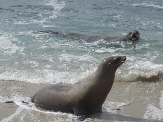
I think the sea lion above was telling his friend "come on in the water is fine"  The crowds here were also over whelming.  I felt for the sea lions when people got into their faces with cameras.  One man also got quite close to a nursing mom with his camera.
The mama pictured above found a safe place to nurse her baby for sure!
On our way home we stopped in Carlsbad.  Driving down the coast earlier we had seen this statue and were intrigued as to who it might be.  Maybe it was Carl for whom the town was named?  No, the statue was John Frazier.  He had a ranch in this area and, while drilling for some wells, found some artesian springs.  He discovered the water to be therapeutic for his chronic rheumatism. Soon Farzier would greet people at the railroad station with the water and say:  "alight, drink and be happy".  A hotel with a spa was built on the site where his statue now is- it later burned down.  The springs were not maintained during the Great Depression and were unused for 119 years.  Now it is being sold by the gallons, as you may see by the water tanks behind Frazier.  A  large truck pulled up while we were there and the advertisement on it noted that the artesian water is "Eden in a Glass", "Most Healthful", "anti-acid water, anti-oxident, soft, delicious, hydrating and therapeutic".   We had no gallon jug to fill up, just poured some into our cup from another man's jug.  Tasted like regular water, maybe a little bit off- tasting.
We also learned from further research that Karlsbad, Bohemia (now Czech Republic) tested the water and found it to be the same as the artesian water in their town.  Maybe that is how Carlsbad got its name- and it is a sister city to Karlsbad.  The statue was created in Europe by a renown sculptor and former mayor of Karlsbad. 


Vista, California

We arrived in this town last week and have been busy since that time.  Vista is a medium-size town in the San Diego metropolitan area.  John Frazier chose the city name in the late 1800s.  I will have more regarding John Frazier in another posting.  Vista was a farming community, following WW11 it grew primarily tomatoes, celery, and citrus.  And it became known as the " avocado capital of the world" in 1948.   Which brings me to the Avo Theater (actual name Avocado), where Beauty and the Beast was performed this past weekend. 
Yes, our son is performing in that musical, and his bio note is on a listing outside the theater- along with the names and bios of about 60 other cast members.  It is community theater, so many are not certainly professional actors, singers and dancers.  That being said, we saw the performance Saturday night  and enjoyed it very much.  Of course, it means a lot more when when you know someone performing in it!  Our son played the baker, a fork, and some other small roles.
Yes, that is him front and center, singing and dancing in the wonderful song "Be My Guest".  He enjoyed performing for the show ,but certainly is not considering quitting his day job anytime soon.
He is also pictured below on stage dressed as the village baker.
 The show had a small orchestra preforming for it, which also made the show quite good.  And if you are in the San Diego area next weekend, the show will still be running then.
We spent a fair amount of time in Vista over this past weekend, as that was the best place to meet up with Mike and hang out with him and our nephew David between shows.  David works for the Jet Propulsion Lab in Los Angeles and drove down here to spend the weekend with us.  It is coincidental that, what with David's interest in astronomy, there is the brewery "Wavelength" in Vista which has some telescopes sitting around.
The brewery advertises that here one can get their fill both of science and beer.  The owners are passionate about science and host a variety of science outreach presentations.  Unfortunately none of them were going on when we visited the brewery.
Vista is an interesting town to walk around in what with its small shops and street art on the corners.  Pictured above is the "Alley Art Man" who seems to be tending to his plants.  What bright red eyes he has!  Over the weekend we also visited a couple other small towns and also drove down the coast to La Jolla.  More on those adventures in my next posting.