Sunday, February 26, 2012

The Mines of Death Valley

Part of our enjoyment in driving through Death Valley National Park was found in seeing the many contrasting landscapes. After driving through miles of dry rocky land it was a bit refreshing to see an oasis where there are plants and trees. The picture above was taken at Furnace Creek Inn. Furnace Creek is a spring-fed stream flowing into Death Valley. The valley gets two inches of rain a year so streams like Furnace Creek are quite important. In 1881 borax was discovered in this area and a ranch was constructed to support borax workmen as well as the twenty-mule teams. The ranch later became a guesthouse and now is a museum. Built in 1883,  it is the oldest structure in the valley.
Our last stop of the day was at the Harmony Borax Works. Here we took an interpretive trail around original mule team wagons (the wagon at the end is a water tank), and the ruins of the mine processing plant.
 Chinese laborers scraped the borax off the flats and then hauled it by wagons to the refining plant. There the borax was washed from unwanted mud and salts. I was in error when previously I indicated that 20 million pounds of ore were hauled out in two wagons at a time- rather that amount was the total hauled out of the valley by mule teams from 1883-1889. My thanks goes to a reader who caught that error! Over a period of 150 years borax, gold and other metals have been mined in Death Valley. The valley's last active mine was closed in 2005. Borax, or the "White Gold of the Desert",  has proven to be the valley's most profitable mineral. By the time we toured the old borax mine the sun was setting and it was time to head home.

Saturday, February 25, 2012

Death Valley National Park

Death Valley National Park straddles the Nevada border in the eastern central part of California. It is a good two hour trip from Las Vegas over to Death Valley. The park, which is the driest, hottest and lowest of all the national parks, encompasses 3,336,000 acres- of which we saw only a small portion yesterday. I certainly now have a different impression of the area. Until yesterday the words "Death Valley" brought to my mind visions of dry, sandy flat land. As you may see from the picture below, that is not true.
 In reality, mountains and large colorful rocks pretty much dominate the scene. On the west side is the Panamint Range and on the eastern side of the park lies the Amargosa Range. It is the mountains, in addition to the low elevation, which keep the park hot. The enclosing mountains recirculate the hot air and prevent it from dissipating at night. Summer daytime highs often reach 120 degrees Fahrenheit and lows may drop to 100 degrees at night. The primary reason for our visit to the park was to see the lowest elevation in the Western Hemisphere. Up to this point we had seen very few cars or other tourists but found them here.
 The lowest elevation is at Badwater Basin. It is a vast salt flat which presently has a small lake dotted with sodium chloride crystals and a variety of other salts as gypsum and borax. The first '49ers crossing the desert took their mules to this lake for a drink of water and the mules refused to even take a sip. Hence the term "bad water". The flats always stay wet because of underground seepage.
 Erosion and other geologic forces (as earthquakes) have been in action over thousands of years to create this basin as well as the many other rock formations we saw yesterday. Our next stop after Badwater Basin was at Natural Bridge Canyon. The gravel road we took to get to the bridge, as well as the hike over to it, was all an uphill climb. The trail took us through a narrow canyon. The natural rock bridge is pictured below. It was a hot walk with the sun high overhead. I will have more on our trip to Death Valley in the next posting.


Thursday, February 23, 2012

Hoover Dam

Yesterday I mentioned Boulder Dam Hotel. Through the years there had been a bit of consternation as to what to call the dam. President Hoover, a trained engineer, strongly supported construction of a high concrete dam on the Colorado River to control its flows. In the 1800s and early 1900s the river would flood low-lying farmlands during the spring thaws and in late summer it decreased to a trickle. In 1928 President Hoover signed into law the Boulder Canyon Project Act, authorizing the construction of the dam. Democrats did not want the dam to be named after a Republican president, so for many years it was called Boulder Dam.  It took an act of congress in 1947 to make it officially Hoover Dam. The dam was the greatest dam of its day. It has been featured as one of the Top Ten Public Projects of the Century, as well as a National Historic Civil Engineering Landmark. The cost of the project, $165 million, has been repaid to the Federal Treasury through the sale of Hoover Dam power sales. There are tours of the dam available, as well as a power plant tour.
There are two power plants. The one we toured, pictured above, has eight massive generators. In the picture below you can see both power plants as well as the dam. In the background is Lake Mead.
Highway 93, a two-lane highway, use to traverse over the dam. Eventually it could not handle the high traffic volume so the highway was rerouted over a new bridge. That was built in 2010, another architectural feat. It is about 200 feet higher than the Arch in St.Louis. While walking over the bridge we discovered that it took us into Arizona and another time zone. The bridge straddles the states of Nevada and Arizona.

Wednesday, February 22, 2012

Boulder City, Nevada

On Monday we arrived in Las Vegas, which was discovered  in 1829. This valley oasis in a desert was called by its discoverer Rafel Rivera "the meadows", because here he found artesian springs. The city that grew up here became one of the most isolated major cities in the United States. The picture above is what we can see from our home, and on the other side of the park is a bustling city street replete with casinos. On our first day here we headed out for Boulder City, a city whose history is very strongly linked to Las Vegas. Boulder City's birth began in 1831. With the construction of Hover Dam looming on the horizon, the federal government need a site to house thousand of workers. That site became the Federal Reservation of Hoover Dam. It was demanded that the United States have control over this city, in effect; no liquor, gambling or prostitution allowed. In 1960 the reservation officially became a city. However, to this day, no gambling or prostitution is still not allowed. What has been forbidden in Boulder City has determined the fate of Las Vegas. Workers for the dam headed for Las Vegas on their days off and dozens of casino opened to serve them. Some of this information we picked up at a museum located in the Boulder Dam Hotel in Boulder City. From there we drove to the dam, I will have more on that in the next posting. Before closing I want to mention another stop we made yesterday in the town of Henderson, at  Ethel M.Chocolates. That company is owned and operated by Mars Incorporated. Frank Mars and his wife Ethel started selling chocolates in 1911 in Tacoma Washington. The company grew and now are the makers of Mars, Snickers, Dove chocolate bars and a variety of other candies. In the 1940s they provided the small colored pieces of candy which we now know as M&Ms for the armed forces. The chocolate bars and M&Ms are not made in Henderson.
We toured the chocolate factory but the only activity we saw was the production of chocolate covered apples. Outside of the factory is a beautiful cactus garden which we also took a walk through. The garden has some beautiful desert trees as well as cactus. Pictured below is the red barrel cactus.

Sunday, February 19, 2012

Boron and Borax

Yesterday turned out to be far more interesting than I had anticipated. I had figured that we would drive to the town of Boron, maybe take a picture of the 20 Mule Train, and that would be our day. Our first stop was in the town of Boron where there is a very good historical museum. There we learned that from 1883-89 there were 20 mules which hauled two wagons containing a total of  22 tons of borax from Death Valley to the Mojave Desert (without one breakdown). The 20-day round trip involved crossing over the Panamount Mountains, so it required one very skillful driver and some intelligent mules. There was also a "swamper",  a man who worked the brakes on the downgrades and encouraged the mules on the upward climbs. In 1913 borax was discovered in the Mojave Desert, outside of the town of Boron. The Borax mine was started in1925. It has since become one of the biggest and richest deposits of borax on the the planet. From Boron we drove to the Borax Mine to see the mining operations in action. Here 12 thousand tons are daily hauled out of an above-ground pit. Now railroad cars carry the final product out to be distributed worldwide.
 
 The museum at the visitor center of Borax is filled with information and displays on the mineral; how it has been used through the centuries (the Romans made glass with borax and the Egyptians used it in mummifying), how it is mined, and processed. The mineral's main use initially here was primarily as a cleaning agent. The museum has a large display showing its many uses. In case you are wondering, carrots also need borax!
  As usual, John took a long time going through the museum so I sat down in the gift shop to watch an episode of the western television series Death Valley Days. Its' sponsor was the Borax Company and from 1965-66 the show's host was President Ronald Regan. How strange to see him hold a box of Borax soap in his hands and to hear him extol the benefits of using that laundry soap! On our way home we drove through the town of Hinkley. The museum in Boron had some displays in regard to the movie Erin Brockovich. Boron was chosen to represent the town of Hinkley in the movie for a more "authentic look" . If you may recall, the movie is about how Hinkley became contaminated by chromium 6.  Erin Brockovich took on the legal battle with a California power company to seek redress for its citizens. The town now has many abandoned homes.


Saturday, February 18, 2012

Afton Canyon

Before driving over to the Afton Canyon we first stopped at Calico Early Man Archeological Site. This is the oldest and still active archeological site in the United States. In the early 1960s prehistoric rock tools were found in this area. They were shown to Dr. Louis Leakey who then made a trip here from England in 1963. Once Leakey had examined the site he applied to Washington D.C. for a grant to pursue archeological digging in the area. In the picture above you can see one of the pits which has been carefully dug out by hand.
Currently digging has continued by volunteers a couple of times a month. This area lies in what use to be a fresh-water lake lake (Lake Manix) which was fed by the Mojave River. Speaking of the Mojave River, we had been wondering where it is- all we have seen are dry river beds around Barstow. We since have learned that it flows underground across the river valley, only surfacing in selected areas.
We found the river in Afton Canyon, as you can see in the above picture. To get into the canyon it was necessary for us to drive drive on a sandy, rocky road. At one place in the road we had to drive over a rather large puddle of water. John kept saying someone told him that the canyon was prettier than Rainbow Basin and he thought that we should drive in as far as possible. Trouble with that thinking is that our little car is not built like a Jeep!  A railroad line runs through the canyon, possibly that is the reason for the presence of any semblance of a road. We finally decided to stop and just start hiking (we discovered later that the road goes on for another 100 miles through the canyon into the town of Baker). As we were standing at the river's edge, trying to figure out how to ford the river, mountain sheep bounded up the hillside near where we were standing.We managed to cross the river on a thick piece of cardboard which was lying on a narrow section of the river. It was necessary to cross the river so we could walk further into the canyon.
John and I walked a distance, maybe a couple of miles into the canyon. We will never know if  the scenery became even more beautiful further down the road, but we were very satisfied with what we did see. We not only saw the patchwork of different colors in the rock walls, but also saw some lush riparian areas.


Friday, February 17, 2012

Calico Ghost Mining Town

Before touring this town we stopped at Peggy Sue's Diner for lunch. It is a restored 1950s restaurant. In the 1980s Peggy and Champ Gabler bought the diner and decorated it with movie memorabilia which Peggy had saved from her acting career in Hollywood. She had roles in 75 movies. A jukebox decorates the entrance to the diner. We were glad we stopped as it is a most interesting place- and the food is good!
The rest of our afternoon was spent in the ghost town of Calico. This town sits in the Calico Mountains, so  named because of the great variety of colors in its soil- like a patch of calico. The colorful rugged mountains are similar to the rock formations which we had seen two days ago at Rainbow Basin. They are part of the same mountain chain.
It was fun hiking around the hills above the town where the mines use to be. We also were able to walk through several tunnels of the Maggie Mine. Calico Mining District was the site of what was once the greatest producer of silver in California. Over fifty mines were in production from 1882-1896, at the peak of the "boom years". During that time 13 to 20 million dollars of the precious ore were recovered. The town of Calico was born in 1881 and became populated with 1,200 people. When the price of silver fell the town of Calico became a ghost of its former self. One of the mine's owners, Mrs. Lane, did live in the town until her death in 1967. Below is a picture of her adobe general store which was built in the early 1880s.
Upon Mrs. Lanes death the house was restored for use by Walter Knott, founder of Knott's Berry Farm. He had bought the town and worked on its restoration in the 1950s and 1960s. In 1966 he donated Calico to San Bernardino County and it was opened for public use in 2001. It is a fascinating town to explore, many  pioneer artifacts are displayed in some of the restored buildings. There are also shops and eating places.

Wednesday, February 15, 2012

Rainbow Basin National Natural Landmark

We arrived in Barstow, California on Monday. Where our home is now parked there is absolute silence; no chugging trains, screaming planes or roaring motorcycles-  just blowing sand. We arrived here when some cold front was moving through, so the first day was spent in our home with windows closed. At night we have had to run the furnace to prevent our pipes from freezing. We are in the Mojave Desert, at 2,000 feet elevation. One local told us that he remembers when it snowed in August. The sun was out yesterday but a cool wind was blowing. I was comfortable in a heavy sweater which I had bought in Alaska. We drove to Rainbow Basin and took an 8-mile loop road which offered us some good views of rock walls which are in the shades of red, brown, green, and white.
While I kept commenting on the beauty surrounding us John was silent. It is amazing that after being married to him for 35 years I still forget that he is color blind! He just does not see what I see. One other aspect of the rocks impressed me, and that was the rock formations.  Over millions of years the earth's crust had a lot of shifting and upheavals. Looking at the huge inclined slabs of rock in the basin, it was possible for me to imagine the massive upthrusts of those rocks- what an amazing testimony to the powerful forces of nature!
Rainbow Basin is north of Joshua Tree National Park, which John and I visited two years ago. It is also located in the Mojave Desert. I suppose, then, it is not surprising to see those trees in the basin. The trees provide a refreshing bright color of green in contrast to all the dry gray and brown shrubs around it. This area has not received any large quantities of rain for quite some time.

Saturday, February 11, 2012

Kern County Museum

 I always inwardly groan when John suggests touring another museum. However, it never fails that I end up enjoying myself and gaining a lot of new information when I do dare to enter a museum. This was true again yesterday when we toured the Kern County Museum in Bakersfield. The museum has been a work in progress since 1941. Over the years it has accumulated 50 genuine and recreated structures and some 1,000 artifacts dating from the mid 1800s to the early years of the 1900s. The structures include an 1891 Victorian style home which once was owned by the County Auditor of Bakersfield. A 1898 board and batten farm house has also been moved to the grounds of the museum.
 With the coming of the railroad the community had to deal with many rowdy railroad workers. Southern Pacific Railroad donated to the museum their small jail which was built on skids so it could be move around as needed.  There is also a reproduction of a wood framed county hospital which was used in the 1870s. At that time the right to feed, nurse and even bury the dead went to the lowest bidder, consequently the care was usually substandard. Starting in the 1850s gold was discovered in Kern County. The Yellow Astor Mine became one of the most famous mines in California, producing millions of dollars worth of gold. In the late 1800s many immigrants flowed into the area to work in the mines or on the railroad. Among these immigrants were people from China. To serve the religious needs of those people a Chinese temple was built in 1870 in Bakersfield. Chinese temples were called Jost Houses. Below is a picture of a reproduction of that temple.
At the turn of the century oil was discovered in Kern County. There were 4 oil fields, making the county one of the top oil producing areas in the United States. Several oil boom towns sprang up in the county, including the town of Fellows. An immigrant woman from France provided room and board for the oil workers and their families at her hotel in the town. The hotel was donated to the museum in 1989.
Kern County's history in relation to to California and the nation is certainly most unique and fascinating . And it place in the pages of history continued in 1981. That was when the first space shuttle to orbit the earth landed at Edwards Air Force Base, which is located in eastern Kern County.

Friday, February 10, 2012

Sequoia National Park

This park is located over 100 miles mostly due north of where we are now parked. During our drive there yesterday we first passed large oil fields, followed by many citrus groves. The trees are currently heavy with oranges. We also noticed a few olive orchards. The land at first was flat but then we came into the foothills of the Sierra Nevada Mountains. Dotted over the rolling hillsides were many vineyards. The road which we took through the park is called the Generals Highway. It is an 80-year-old roadway which once was a wagon road. The road can be seen in the picture above. According to a park brochure, "a skin of pavement" barely improved the original wagon road. A rather intense effort is now being made to upgrade the road, which made traveling through the park a bit difficult for us yesterday. Every two hours the road construction crew opens the road for traffic, so we had to plan our day there accordingly. We did make it into the Giant Forest. Within this forest plateau grow the largest trees on the planet, the giant sequoias. These trees grow naturally in 75 separate locations along the western slope of the Sierra Nevada.  Four of the five largest sequoia specimens are in the Giant Forest.
 Pictured above is the General Sherman tree. It was first measured almost a century ago and remains recognized as the worlds largest tree. It is 2,200 years old. There is very little that can hurt the sequoia. Chemicals in the wood and bark provide resistance to insects and fungi and thick bark insulates them from most fires. I could only stand under this tree, look up at it, and say "wow". We tried to hike on the Congress Trail which is a 2-mile-loop that begins and ends at old Sherman, but snow and ice made that difficult to accomplish.  After about a half an hour of slipping and sliding on the trail, we had to turn back.
 
The mountain vistas in the park are stunning. While waiting for road crews to open the road in the late afternoon, we stepped out of the car to look out over the foothills and distant valley. It is called the Eleven Range Overlook. The picture below just does not do justice to what we actually saw before us.

Thursday, February 9, 2012

California Living Museum

I usually don't discuss our visits to zoos, and actually we rarely visit them because of the great zoo we have back in St.Louis. John and I, however, were a bit intrigued by the zoo in Bakersfield. It advertises that its focus is exclusively on California native plants and animals. That sounded interesting to us. But what we actually liked about our visit today  was that so many of the 200 plus animals in the zoo were very active and responsive to us while we were there. I have never in my life had a porcupine come up to me and beg. I had nothing to feed him and there was no way I would pet him! He was so cute gazing up at us and making some kind of a soft snuffling sound. We later talked to a staff worker about the porcupine and he commented that the animal was slow to come around but now is friendly to staff workers- even likes them to rub his belly! Maybe that was what he wanted from us.
 Shortly after coming into the zoo I kept hearing the "who-who" of a owl. So after visiting the porcupine I hurried over to the aviary section of the zoo. There I found, in one of the cages, a great-horned owl giving me a fierce look, all the while continuing to hoot. It was interesting to watch the owl's neck puff out with his vocalizations.  And how unusual to see both him and the porcupine out in the open during the day, as they are supposed to be nocturnal animals. While I was watching the owl, I heard a talking bird in a nearby cage. A zoo keeper, who happened to be walking by, informed us that they have a talking crow- his only words are "so what". And speaking of birds, there was a roadrunner in the desert section of the museum who came up to the edge of his cage to check us out- it was great to see that bird so close-up. And in another cage an acorn woodpecker was chattering away and  kept flying against the bars.
 I am not sure whether he was just being friendly or wanted his freedom. It especially disturbed me to see both the golden eagle and bald eagle in cages-  when we have seen them soaring high in the sky in the wild. But we did learn later that many of the birds/animals at this zoo are unreleasable because of physical disabilities. I also learned that the word "balde" in the old English language means white, which explains how the bald eagle got his name; he certainly is not bald! As I mentioned earlier, many of the animals in the zoo were out and active, and that was true also of the big cats. The mountain lion, pictured below, struck a good pose for me. What a fun day we had at the zoo! Only the black bears did not come out to play with us.
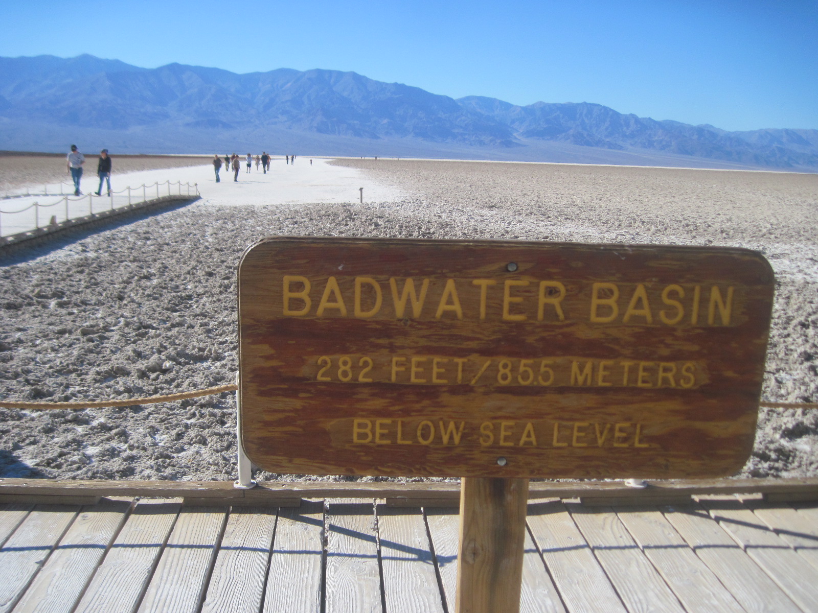
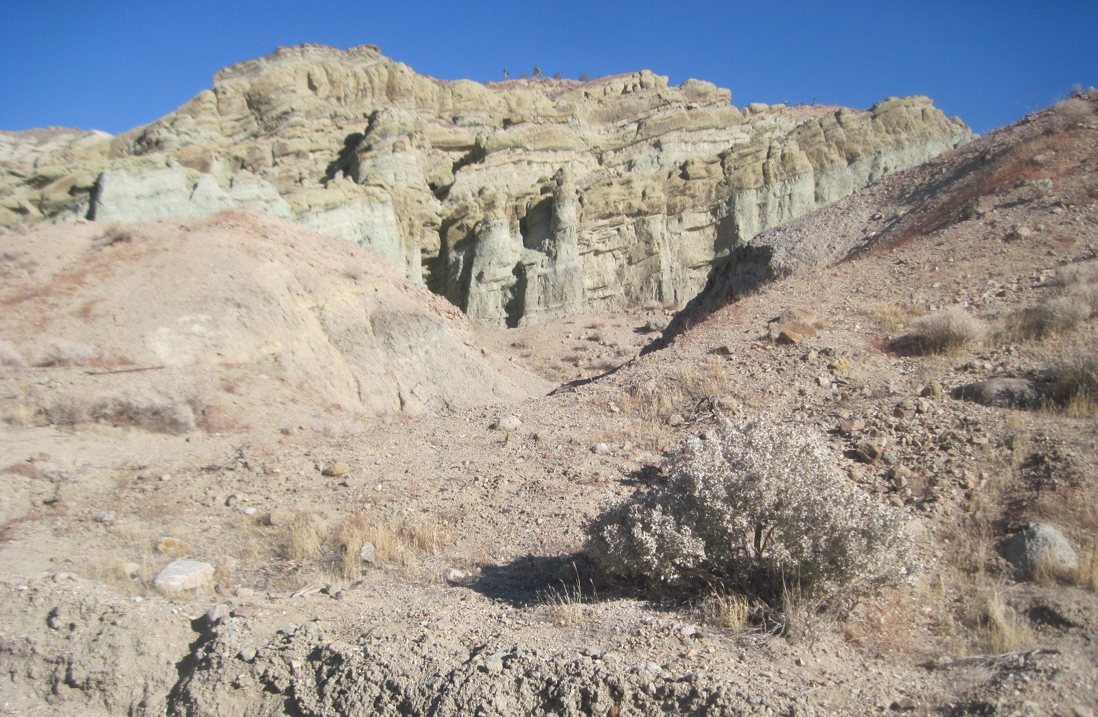
The zoo overlooks the Kern River Valley. On our return trip home we stopped at Hart County Park, through which the Kern River flows. There are many river canyons in the area with hiking and biking trails through them. We took a quick walk on one of the trails at sunset. The land is semi-arid and, except in the riparian area, desert plants dot the landscape.

Wednesday, February 8, 2012

Buck Owens' Crystal Palace

We have moved to Bakersfield California, and it is nice finally to feel some open spaces. We were so totally surrounded by other recreational vehicles in our last park in Los Angeles, that on our first day here I just stared out over the open land around us. From our home I could look out at the mountains on our left and to the right, within the boundaries of the park itself, are numerous palm trees
 However, we are still plagued by the activities of a busy city. Bakersfield is an excellent crossroads for business and tourists. The only year-round passable road and railroad south of Sacramento for exporting the Valley's goods to the east is here in this town. And our home is sitting close by the railroad tracks! On the highways (which are also close to our home) large trucks filled with oranges can be seen heading out of town. Our first day here, Tuesday, was windy and rainy. We ventured out toward evening to explore the town and to check out Buck Owens' Crystal Palace. We discovered that the country star's restaurant would be opened for the dinner hour, and that a country music band was scheduled to play that evening.
 It was a good show and, much to our delight, they played a lot of oldies from the 60s. The Crystal Palace has on its walls many of Buck Owens' memorabilia (he died in 2006). His Cadillac hangs above the bar.
In the lobby of the building there are many statues of other country western stars, including Johnny Cash and Elvis Presley. And, while wandering around the building, I also found out that Buck Owens played with Ringo Starr. That was a connection I had not expected.


Saturday, February 4, 2012

Wilshire Boulevard, Beverly Hills

John wanted to visit the Petersen Automotive Museum on Wilshire Blvd. in Beverly Hills. As we arrived near the museum we noticed signs along the boulevard proclaiming this area as the "Miracle Mile". John later learned, at the museum, that in the early 1900s this road was once an unpaved farm road. A developer got the idea that he wanted to build stores in this area to rival downtown Los Angeles. The plan was for this shopping district to attract the automotive traffic rather than pedestrian buyers. I chose to walk the boulevard rather than spend my time in a museum looking at old cars and learning about the development of the car industry in Los Angeles. Below is a picture of a busy street corner in Beverly Hills. The road seemed to have a combination of high rise buildings as well as many small shops and restaurants.
The more upscale shops of Beverly Hills are located a couple miles west of this area on Rodeo Drive. Not too long after I started walking east on Wilshire I could smell the tar pits. These pits have bubbling tar in them, and Pit 91 is our country's only urban fossil excavation site. The asphalt beds trapped and preserved prehistoric plant and animal life.The pits are fenced off so it was difficult to obtain a good picture of them.
There is a museum near the pits which displays the fossils and also visitors can view how they are cleaned, identified and catalogued in the paleontological laboratory. More than three million fossils have been recovered. Again, the idea of being in a museum on a sunny day did not appeal to me. I wandered around  the tar pits and a Pleistocene Garden near them. From there I walked to the Los Angeles County Art Museum. Below is one of the sculptures located on the grounds of the museum. The head of a hare stares over the beautifully landscape gardens.
 Most intriguing to me was the 120 cast-iron street lamps located on Wilshire Boulevard in front of the art museum.The artist, Chris Burden, collected these lamps from Los Angeles and adjacent cities. According to him the artwork, called Urban Light,  "ultimately is a statement about what constitutes a civil and sophisticated city after dark, safe and beautiful to behold". It was fortunate that when I took a picture of it the lights had just been turned on. Quite a few people seemed to be fascinated with wandering between the rows of lights. Maybe being under the lights gives them a feeling of nostalgia for a bygone era.

Thursday, February 2, 2012

Balboa Park

If everything goes according to plan, we will be moving to Bakersfield, California Monday. Yesterday was our last time to attend the Prime Time luncheon at First Lutheran of Northridge. It is hard to believe that during our two months here we have met such wonderful friends at this church. So many expressed their unwillingness to let us go, and we feel the same way about leaving them. That is the biggest problem with the free wheeling life style which we have adopted! At the luncheon we met another retired couple who have done something even more radical with their lives. Dr.Dennis and Paula Lofstrum put their retirement plans aside and started a medical center in Tanzania, Africa. They have formed International Health Partners with the Victoria Diocese of the Evangelical Lutheran Church of Tanzania. They spoke at the luncheon of the progress they have made in the ten years since they built their first clinic. Paula  talked about all the wonderful people around the world who have aided them with their service and money, which has made possible many healing miracles for Africans. Now she and her husband are traveling around the states telling their story to anyone who is willing to listen and open up their wallets. Hmmm, I guess if our travels here in the states get too boring, there is always the possibility of John and I traveling to Tanzania and doing some volunteer work! After the luncheon we headed to Balboa Park to work off our meal.

We walked around the lake twice, observing the activities of the people and birds around the lake. Many snowy egrets were around the lake, as well as the occasional solitary great blue heron.
Speaking of egrets,  we have also learned to look up to find them.
 We also saw some trumpeter swans. This is a good time of the year for sighting migratory birds here in California. The black spots in the lake are coots, a type of marsh bird. Some of the birds in the lake are also cormorants. The latter are easy to identify as they swim partially submerged.