Friday, August 28, 2015

Leaving Colorado, Heading Eastward


We have been on the road several days now, heading east.  However, I still have some final notes about Colorado which you may find interesting.  I had mentioned the Grand Valley, which had the wonderful peach orchards.  The older name of the Colorado River was the Grand River, hence there is Grand Junction and Grand Valley.  And I have more more item here about Grand Junction.

There was one sculpture in downtown Grand Junction which I did not mention, however, since then we have learned that the sculpture of James Dalton Trumbo may be of interest to some people as there is a movie coming out about him.   Sign near this artwork notes that he was “Grand Junction’s most famous export”.  He was an academy-ward winning screenwriter, author, playwright, “erudite firebrand and blacklisted member of 1947s infamous 10”.    Some of his more famous films included Spartacus and Roman Holiday.  He would write forever in his bathtub.  It seems that a movie of his life would be interesting to see!
One last picture of Colorado.  I tried to soak in the high red rock views before we hit the
Plains and Midwest.  We took north Colorado highway 13, and once in Wyoming, interstate 80.
At our first campground in Wyoming we met a young couple and their tiny home.  They had just purchased it and were moving it to northern Ca. where they planed to live.  That night was going to be their first night in their new home.  I watched the man hook up his home to water and electric- just like we do with our motor home.  He said his pick-up truck had come to close to over-heating towing the home over the mountains.  Like us, they had taken a route north through Colorado to avoid crossing the Continental Divide.
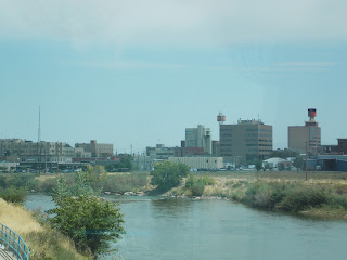
Coming into Casper we began seeing portions of the North Platte River, pictured above.  I did not think I would enjoy seeing a larger town once again.  We had gone only through small towns up to this point, including Lost Springs with a population of four!  Crossing the plains of Wyoming I could not help but think of the early pioneers crossing the same land in covered wagons.    Occasionally we would see roadside markers denoting areas of the trails they once used- including the Oregon Trail.   Other roadside markers noted places of Native Indian battles.  In Nebraska we stayed Wednesday night at Fort Robinson park, near Crawford, Ne.  It had been a military fort until after World Wat ll,  and now is quite an extensive museum with with many of the original buildings restored.  Walking over its grounds I could not shake the feeling that it is a sad place.  In 1878 149 North Cheyenne Indians (the number included women and children) were imprisoned in the cavalry log barracks.  They were given inadequate food, water or heat with the plan to force them into submission.   In January of 1879 they tried to escape, the soldiers pursued them until all were either captured or killed.  I know, there is a lot more history in the fort over its 40 some years of existence than the one incidence with Indians, but once I learned of that story I did not care to walk around the fort any longer.   Some of the buildings of the fort are pictured below.  

We are now in North Sioux City, South Dakota.  Hard to believe that we were in Colorado four days ago.  And as we came into Sioux City, we crossed the Missouri River- which made me realize how much closer we were getting into our own home territory of Missouri.

Tuesday, August 25, 2015

Peaches and Dinosaurs

While in Colorado we noticed that the very best peaches in grocery stores come from Palisade, Co.  Consequently we were thrilled to find out that we are parked close to that town and its peach orchards. Palisade is only about 15 miles from Grand Junction.  In the town of Delta we saw a mural which celebrates all of the fruit of the Grand Valley, which also includes cherries, apples, and pears.
We are in dessert country in Grand Junction, the average temperature every day here has averaged in the mid- nineties.  There is arid land here, and there is also lush green land with trees and grass.  The Redland First Lift Canal has carried water from the Gunnison River since 1907.  It has turned the arid Redlands into profitable fruit and vegetable farms.  I heard on the local news the other night that Colorado may pass legislation dedicating a certain amount of land in this valley for only the purpose of orchards.  This morning, while looking over the Valley from Riggs Hill, I can understand the concern of the farmers.  Development of residential homes seems to be encroaching on orchard land.
That is a new sub-division pictured above, in the middle of farm land, a water canal is the light blue area.  We did not need to drive to the orchards last Friday, but we did and bought half a bushel of peaches.  They are large, sweet and juicy!  We also discovered a number of wineries in that area.   And there is a Farmers Market every Thursday afternoon which is located on Main Street, in the downtown area of Grand Junction.  When we visited the market we noticed that practically every farmer was selling peaches, as well as other fruit and vegetables.  The Grand Valley has a lot to be proud of with its very productive farms, thanks to a water supply provided by the Colorado and Gunnison Rivers.
While strolling around the Farmers Market we notice a variety of sculptures located in the downtown section of Grand Junction, part of their Art on Every Corner project.  I thought the dinosaur on a bike was a cute idea for the town.  Besides peaches, Grand Junction is the location of some dinosaur bones.  Earlier in this posting I mentioned Riggs Hill.  In 1900 Elmer Riggs (Assistant Curator of Paleontology at the Field Museum in Chicago) and his party came to a hill overlooking Grand Junction and found huge fossilized bones of the dinosaur Brachiosaurus.  While climbing Riggs Hill we saw the replica of the backbone of a dinosaur.  I can imagine the excitement a paleontologist would feel finding bones of that size.
In 1937 another scientist found partial skeletons of other dinosaurs 42 feet above Riggs' quarry.  Unfortunately, due to lack of funds, the bones were not removed and souvenir hunters took them. 
We are leaving this area today, fortunately our refrigerator is full of peaches!


Friday, August 21, 2015

Colorado National Monument

Here we are back again;   in a park with deep canyons, towering cliff walls and natural rock structures.  The high country of Colorado National Monument rises 2,000 feet above the Grand Valley of the Colorado River.  The park is part of the greater Colorado Plateau, which includes the geologic wonders of such places as the Grand Canyon and Arches national parks.   So we can expect more of what we have been seeing in the past week or so.  However, John and I can still always anticipate a few surprises, and this park did not fail us in that regard!
As at Black Canyon, we took the Rim Rock drive of 23 miles to take in some of the awesome views of the park.  One of our first stops was at Window Rock.  It was necessary to take a short hike through pinon-juniper woodland to get a good sighting of the very large structure pictured above.

The picture above shows the heart of the park.  The largest free-standing monolith on the left is called the Monument.  It was once part of a massive rock wall.  Behind it is Kissing Couple and Sentinel.  To the left of Monument is Praying Hands and Pipe Organ.  John Otto and artist Beatrice Farmham were married in front of  the Monument 1911.  She discovered that the "reality of his life was far from ideal" and left him a few weeks later, never to return.  Otto has a memorial at the Visitor's Center.  He loved the park from the moment he explored it and his memorial states he was a trail builder for it, and promoted the park.  He was its first custodian.  In 1911 President Taft designated it as a monument.
At the visitor center we were fortunate to have a geologist explain to us the different layers of rock which we were seeing in the park.  Those layers represent millions of years during which rock and sediment have built up.  Over those years inland seas have come and gone and erosion has sculpted the rock into shapes we see today.  Fossilized dinosaur bones and tracks have been found in that rock in this area of Colorado, the geologist had replicas of a few of them, including dinosaur dung!   Shortly after we had left the center, one bighorn started trotting down the road in front of us, followed by another.  By the time I got my camera out, they were running off into a ravine.
 
Another interesting area of rock structures is seen at the coke ovens.  That name was given to them because they look like the ovens used to transform coal into coke.  There were several other interesting overlooks into the canyons of the park, one of which is artists point.  An area of canyon there best shows the palette of color which paints the rocks found in Monument's landscape.  We also stopped at Cold Shivers Point, just because we were intrigued by the name.  There it is possible to stand at the edge of a cliff and peer thousands of feet below into the canyon.  Didn't give us the shivers, we have been having those experiences a lot in the past weeks! 


Thursday, August 20, 2015

Lower End of Black Canyon

We had just started down the road to the river when I espied a bird  by the side of the road.  I am thankful that John is usually willing to pull over and stop when I give a shout out!
Pictured above is a Gunnison grouse, related to the greater sage grouse.  His habitat is limited so we were fortunate to see him.  It is a steep and winding road down into the canyon, like 16 per-cent grade.  We had 5 miles of that before we reached bottom.
We had just started our drive along the river when we noticed a few cars pulled over to the side.  People were getting out of their cars and pointing to the hillside across the river.
I am thrilled that after all this time in Colorado we finally saw a bear!  Further down the road other people also saw a mother bear and her cubs, we did not get a good sighting of them.
From 1904-1912 Gunnison River became America's first reclamation project.  A diversion dam and 5.8 mile tunnel was built through the canyon for flood control, irrigation and hydroelectric power. We were able to see the dam as well as part of the tunnel as we drove along the river.   Eventually three more dams were built, which tamed the river.   The erosional forces of the Gunnison River will no longer be making its impact on the canyon.


Black Canyon of the Gunnison National Park

Unfortunately the northern back country of Colorado was covered by a smokey haze yesterday when we drove west from Grand Junction to see this park.  It is coming down from the wild fires in Washington, weather reports claim this may clear up in another day or so.   We still had a great day during our visit to the Black Canyon.  It is one of our newer national parks (1999), but it has been a national monument since 1930.  The first explorers here in 1870 claimed the canyon "inaccessible and foreboding".  The first men exploring the canyon wrecked their two wooden boats on the Gunnison River which flows through the canyon.   Characteristic of the river then was that it was fast flowing and debris-laden with rocks and other sediment..   Of course, the river has, over time, carved out the beautiful canyon we see today.
The canyon is black because a lot of it is in shadows, and also because the river first started its course over volcanic rock.  It is one of the greatest canyons in North America because of its combination of depth, steepness and narrowness.  Its steep walls range in depth from 1750 to 2,700 feet.  At its narrowest point it is a quarter of a mile across.   Painted Cliff is 2,000 feet high- the Empire State building, if place on the canyon floor, would only come to half of the wall's height.  The cliff is the tallest in Colorado.
One thing which intrigued me about this canyon is in some places it sparkles, or is crystalline.  After the volcano occurred many years ago, molten rock squeezed into fissures forming the light-colored bands which thread the canyon's dark walls.  As the hot fluid slowly cooled and hardened minerals formed and crystallized.   Flecks of mica, feldspar, quartz, and perhaps even garnet can be found in those light-colored bands seen in the picture above.  Information provided by park interpretive signs.
After we had made quite a few stops along the rim of the canyon viewing its unique features, we were ready to drive down into the canyon and explore its riverside area.  I apologize for the poor quality of pictures here- between the haze and the fact that it is a black canyon, my camera seemed to do a poor job of capturing the beauty of this park!


Tuesday, August 18, 2015

Flora and Fauna of Southern Utah

For all of the wilderness which we have seen in the past couple of days, one would think that we would a lot of wildlife.  Unfortunately all we saw were a few deer and lots of lizards.
We saw this lizard at Arches park.   It seemed that he was posing for me, but from information which I found in the visitor's center, that is "freeze behavior" which they do when threatened.  Most common lizard in the park is the leopard lizard, not sure if that is one of them.  They are endangered because of  farming, mining and off road riding vehicles.  The latter are quite popular in the national parks of Utah.
I know, what is there exciting about a raven?  We had one as a dinner guest during our lunch stop in Canyonlands.  During the meal he sat in a tree with his back to us, pretending to ignore us.  While we ate we accidentally dropped a few minuscule crumbs of chips and cheese.  We were tempted to leave bread crumbs but know that it is best not to feed wildlife.  After our meal, and once we left the picnic table, the bird came down, checked the bench and table.  He found the small crumbs and ate them.  He seemed to know exactly where they were.  Another car drove up to have lunch at the same table, and the bird returned to his vigil in the tree.  Ravens seem to be as smart as crows, which is how they are good survivors in any environment.
A not so common bird we saw were chukars.  I could not get a picture of them because they were busy scurrying across the road.  They are a type of quail brought in from the old world to America as game birds in the 1930s.  Another unusual sighting we had was that of a great blue heron sitting in a shallow area of the Colorado River.  He is the only one we have seen in Colorado so far.
 
As I wrote in another posting, this part of Utah is desert.  To see the delicate dwarf primose in this harsh setting of scrub land is a joy to behold.  They open in the earlier hours of the day, and we had arrived in the Canyonlands in time to see them in their full beauty.
 
Actually the desert is quite pretty at this time of the year, as there are many plants blooming now.  The Utah juniper is covered with modified cones (they look like wax-coated bluish berries), and reminded me of a Christmas tree with blue lights.  The waxy-greenish yellow foliage and cones help this shrubby tree conserve moisture.  As to flowering plants, yellow seems to be the dominant color in the desert at present.  Pictured below is the rabbit bush.
In Arches and Canyonland parks there are many signs warning people to stay on the paths.  The reason is to protect the black biological soil crust pictured above.  It is a complex living mixture of organisms made up of cyanobacteria, lichen, algae, fungi and moss.  Plant seeds that land on this mixture have a greater chance of germinating than those that land in loose, dry soil.  The signs posted in the parks warn that those black spots are very fragile, one careless step can destroy decades of growth!
Today we left Moab, crossing the Green River as we left town.  We are now in northern Colorado, and as we came into Grand Junction we started seeing the Colorado River, it feels like we have come full circle.  Fortunately here it is a bit cooler, and we are seeing a lot more green foliage in the way of grass and trees.


Additional Sights of Canyonlands

We just never knew what we were going to see when we came to an overlook in this park, usually it was a surprise.  That can be said for Grand View Point, which has tall spires standing starkly in deep canyons.
As a sign near this overlook notes: : " the relentless forces of water and gravity have sculpted the vast canyons.."mere drops of water chisel dramatic cliffs, spires, mesas and buttes".  Using my camera I zoomed down into the canyon to get a better view of one of the formations.
Hard to imagine, this park has thousands of such formations here in Utah's high desert country.  All total the Canyonlands has 337, 598 acres of colorful canyons, mesas, buttes, fins spires and arches.  Which brings us to one of the park's more popular tourist sites, Mesa Arch.
It was a short hike to this area, the path was quite sandy with short sections of slickrock.  It was not possible to traverse it very rapidly!  When we got there many family groups were lined up to have their photographs taken under the arch.   Off in the distance is framed the La Sal Mountains as well as three formations pictured below.  While we were there a few sprinkles of rain came down.  We saw a movie in the visitor's center later which noted that an average of 9 inches of rain comes down in this area yearly, on average.
Washer Woman Arch stands in the left foreground, Monster Tower is the large pinnacle to its right,  and
Airport Tower is the isolated butte behind them.   One last picture here, that of John looking over a canyon.  It was amazing to me how many overlooks are unprotected with guard rails, one certainly has to watch
their step when moving close to the edge in this park!  


Canyonlands National Park


As I am sitting here and writing this post I am looking out at the sun setting on red cliffs and the La Sal Mountains beyond them.  It seems like large red walls are all around us here in Moab, Utah. Yesterday, Sunday, we took a drive on a scenic by-way along the Colorado River.  That river has carved out the many canyons in this area, as well as the Grand Canyon.  Pictured below are the cliffs along that highway.
 
As you may know from my last posting, we saw Arches National Park Saturday- and that was more red rocks.   The build-up of differing layers of sediment (sand and rock) started with inland seas which came and went over millions of years.  Large rock structures formed and changed over time as they were eroded by wind and water.  That is about as simplistic as I can make it!   After entering the park we drove a distance over a mesa covered with desert landscape until we came to the vista pictured below.  This part of the park is called Island in the Sky, and it is only section that is easily accessible to the public.  Two other districts of the park are called The Needles and The Maze. The latter is the most wildest, as well as remote.  At center stage of this park are two canyons carved out by the Green and Colorado Rivers.
A sign at this overlook notes that on a clear day it is possible to see as far as 152 miles.  As you can see, today was not a clear day, but we were glad it was overcast.  We did not want a repeat of Saturday when by late morning it was close to 100 degrees.  Today the sun did not show up until at least noon.  We had a pleasant hike to Upheaval Dome which is pictured below.
Here rock layers fractured and tilted forming a circular depression which is two miles wide.  Scientists do not know whether this is the result of a meteorite impact or the remnant of a salt dome.  An interpretive sign explained the latter phenomenon this way: when seas dried up they left thousands of feet of sand.  Sediment covered that.  Salt rose, fracturing and destroying rock layers in its path.  Water eroded the salt and over-laying sediment, exposing the crater we see today.  That is one explanation for this anomaly in the land of canyons.   By the way, we have seen a lot of red sandstone, but there is white also- as seen above.   The white sand came from ancient coastal sand dunes.
Just about in the middle of the picture above is the Green River.  Around that area is the confluence of the Green and Colorado Rivers.  The rivers and canyons here were explored by Major Powell, a one-armed Civil War veteran and geologist in 1969.   He wrote the following: "this is a strange weird region" of naked rocks with "cathedral-shaped boulders towering hundreds or thousands of feet, cliffs that cannot be scaled, and canyon walls that shrink the river into insignificance".   All information here that does not sound like my own brilliance came from information which the park provided!  More on this park tomorrow.

Saturday, August 15, 2015

Arches National Park, Utah

On Friday we moved our home to Moab, Utah.  We are now in dessert country, and it is hot.  We learned how hot when we did some hiking this morning around Arches National Park.  There are signs all around the park to remember to always carry water.  The elevation of 7,000 feet above sea level, plus temperatures hovering around 100 degrees can make one thirsty very fast  which we found out. 
As you can see in the picture above, not much shade is available either, so John and I just opted to take the easier, short trails to see some of the rock formations in the park.  Those rock formations include arches, spires, balanced rock and sandstone fins. They were once solid layers of sandstone, but stresses within those rocks caused them to crack, water and ice continued the process of erosion.  The first trail we took was into the Devil's Garden.  Here we saw the Pine Tree Arch.
Also on this trail is Landscape arch, which has an interesting story.  In 1991 hikers near this arch heard a loud crash and popping sound.  Some rock debris tumbled down from this slender arch which has a 306-foot-long span ( it is the longest arch in the park, the smallest has a 3 foot opening).  That rock was followed by a large slab which peeled away from the arch's right side.  When the dust settled 180 tons of fresh rock debris lay scattered under the arch.  Scientists think that the heavy rain which fell 10 days before may have filled the pore spaces of the sandstone arch, adding more weight than it could handle. 
Walking to Sand Dune Arch was a bit easier than the earlier trails, and big rock monoliths along the way provided some shade.
The arch is not actually broken, it just has a crack in it.  Hard to believe, but there are 2000 cataloged arches in the park!  Some of them, and other rock formations, are visible from the road.  By late morning it was just too hot to be out, we finished up by doing a driving tour of the park.  Pictured below is Balance Rock.


Mesa Verde National Park

Yes, we were thinking that we were not going to visit this place again- but we did and were very happy that we returned.  For some of you not aware of this place, it is an archeological heritage site of the Ancestral Pueblo people who lived here from AD 550 to AD 1300.  The park includes some 4,500 archeological sites, only 600 are cliff dwellings.  The homes can be found on the tops of mesas, as well as in the alcoves of the canyons.  When we arrived at the visitor's center by about mid-day the only guided tour time that would work for us was the 2:30 PM Balcony House tour.  We were warned that it was one of the more physically difficult tours to undertake, John said he was "game"- I agreed with some trepidation.


The picture above should give you an idea of the sheer cliffs where the dwellings were built.  We had ladders to get into the Balcony House, the pueblo people just used toe- holes in the rocks to assist them in climbing the sheer cliffs.  I cannot image also carrying a child on my back, or a large stone for construction purposes while accomplishing that climb!  At least it was not necessary for them to carry water up, there is a spring in a back alcove of the house.  Again, before we started our tour the park ranger encouraged us to think about how we physically felt before taking the tour.  She warned us that the tour included 5 ladders to climb, one of which was 32 feet.  We would also have to crawl through one tunnel, as well as two narrow passageways.  The first ladder we climbed was the longest one.
 The ranger gave us a most helpful hint regarding climbing that ladder, and that was to only look at our hands and not to look down in the canyon- that worked for me!
The cliff dwelling has living and storage rooms, as well as work and ceremonial rooms. In the foreground of the picture above is the latter, also known as a kiva.  It has a hearth in it, which the other rooms do not.  Scientists believe that during the cold winter months everyone gathered and slept in one of the two kivas in the dwelling.  It is believed that this dwelling held 20-30 people.  The kivas had walls and a roof at one time, and a ladder which led down into it from a hole on the roof. 
 
Before the park first opened in 1906 archeologists needed a plan to preserve and protect the cliff dwellings and pit houses.  The features of the sites needed to be stabilized and reinforced with original methods and materials.  However,some of the original masonry can still be seen in the Balcony House.  Also, some accommodations needed to be made for tourists to get through different areas of the house- passageways needed to be widened.  The ancient people averaged no higher than 5 feet 4 inches in height.   Pictured above is the tunnel we had to pass through to get into another section of the house.  John and I had no problem with climbing up and through that house!  I think their warnings were a bit over-blown.  After that tour we took a loop drive through the park to view some of the other cliff dwellings.  Balcony House is the fifth largest of the cliff dwellings, Cliff Palace the largest, it is pictured below.  It has 150 rooms and 21 kivas.  Scientist estimate that 100-120 people lived there.

Our last stop in the park was Park Point, the highest elevation on the mesa.  From here it is possible to receive an unobstructed 360 degree panoramic view of the area.  To the north and south mountains can be seen, including the San Juan Mountains.  Those mountains, as well as the rugged canyon and mesa country,  form the backdrop for the prehistoric Pueblo ruins which we had just seen. 

Thursday, August 13, 2015

Million Dollar Highway

It was getting on late into the afternoon, but we decided to continue on our journey, after all, there were some waterfalls to see in Ouray.   We found the first, just outside of Ouray, it is called Bear Creek Falls.
The highway is just above these falls which cascade into the Uncomphagre River.  At this overlook site there were informational signs telling the story of the Million Dollar Highway.  In 1882 two men built 12 miles of the Ouray and Red Mountain road, at a cost of $10,000,00 a mile.  The passage through the Uncomphagre River Canyon was difficult and expensive to build, so to recover their costs a toll booth was set up above the falls.  It cost $5.00 per wagon and $l.00 per head of livestock to cross the road.  There was no other road for passage over the area, people had to pay the fee.  Another explanation for the name given Highway 550 is that, while driving over it, people receive a million dollar view of the mountains, alpine meadows, forests and hot springs and waterfalls!
The town of Ouray to me is the most scenic on the Million Dollar Highway.  It reminded me of an alpine village, and has a nickname of the "Switzerland of America".  It sits in a canyon and is nestled at the base of the San Juan Mountains, everywhere we looked while we were in the town we could see mountains.
By now it was late in the afternoon, never thought we would travel this far.  Sign to the falls said it was only 1/4 mile hike to them, and we thought that would not take much time.  There was no accounting for some rock scrambling and steep climbing at the end of the trail, however!   Before we left the town there was still one more waterfall to see, that one is located in Box Canon Park, on the northeast side of Ouray.
These waterfalls were the most unusual of all the falls we have seen.  To find then we needed to stay on the red metal boardwalk pictured above.  As we entered the depths of the cave we could hear the roar of the falls but never saw them, only felt a fine mist on our faces.
Pictured above are the falls, coming down behind the rock walls.  From what little we saw of them, it was hard to believe that they are 20 feet wide and 285 feet high!  We did not get home until 7:30 PM, it had been a long day, much longer than we had anticipated.  But we did not regret one minute that we had spent seeing all the natural wonders of the Million Dollar Highway!