This road is also called the San Juan Scenic Highway, or the Million Dollar Highway. Anyway, we decided that we want to see the part we missed last Friday. And rationalized it all by saying that we would only go as far Silverton, just a little road trip. Coming out of Durango we noticed several cars parked at what seemed to be some kind of roadside attraction. Just had to stop and look.
It is the Pinkerton Hot Springs, named for Judge Pinkerton who owned the land back in 1875. These springs are not too far from our home. There is another hot springs across the street from us, water from those springs run down in a little creek near our home. It is interesting to see the steam rise from the creek when the nights get cold! I should at least soak my feet in that water before we leave.
Coal Bank Pass was our first stop, it is the second highest summit on the San Juan Skyway. Notice the yellow wildflowers in the foreground. The wildflowers we saw along the highway were about as equally stunning as the mountain vistas. One area, coming out of Durango, has so many white flowers it makes the ground look like it is covered with snow. Our next stop, Molas Pass, also had quite a display of them. A young man used that backdrop as the scene for a wedding proposal while we were there.
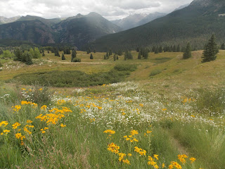
The young lady did accept the proposal. At this stop we were able to get a great view of the Weiminuche Wilderness. It is the largest wilderness in Colorado, encompassing 488,700 acres. Here at this overlook there is an interpretive sign noting that from the San Juan Mountains one can see for 170 miles, the longest sight distance in North America. It also noted that up here the air is quite pure. On that note I want to write here about what is now not so pure, the Animus River. We could see that river snaking through Silverton when we stopped off the highway to look down at the city.
As many of you know, the river has been contaminated by mine tailings from King Mine, which is north of the city. I will not go into the details here, but John and I saw the polluted water 24 hours later after it happened while biking along the river in Durango. Fortunately the water today is now a light green color and word on the news this morning is that people can go back on the river by next Monday.
After lunch we drove north of Silverton into the mining area. Mining equipment, sheds, chutes, as well as ore cars dot the landscape. Scrap ore from the gold and silver mining cover the hillsides, and any little rivulet of water is colored the same color orange as we have been seeing in the Animus River. At one of the mine sites there is a sign put up by the Idarado Mining Company that they mined the area from the 1870s to 1980, and got out of the mine 4 million ounces of gold, 21 million ounces of silver. The sign also noted that mining the ore fueled the Industrial Revolution as well supplied raw material to aid America during its two world wars. Since the 1980s the company has taken on reclamation efforts to clean up the land. We saw no reclamation efforts in progress as we drove through the area, I guess as Paul Harvey once said, "now you know the rest of the story". A mined hillside is in the picture below. I will continue the tale of the rest of our drive on the scenic highway in my next posting. I am so glad we did not stop at Silverton, there was still so much to see!
Wednesday, August 12, 2015
Chimney Rock National Monument
As I had written in a previous posting, we had seen the cliff dwellings at Mesa Verde and were ready to see something different regarding the Ancient Puebloans. We found that at Chimney Rock, which was declared a national monument in 2012 by President Obama. Chimney Rock is in the background of the picture, Companion Rock in the foreground.
For a thousand years the land beneath these two spires was the home to many people, and in more recent years, one of the most intriguing archeological sites in the Four Corners area. Architecture of the buildings here, as well as pottery and other artifacts, tell a story of the people who once lived here. We took a guided tour on the two trails here which showed their pit and pueblo houses, as well as their ceremonial buildings, better known as kivas. Pictured below is one of the pit houses constructed around 1078. It was excavated and studied in 1972. For your enlightenment, dendrochronolgy (study of tree rings) makes it possible for archeologists to do the dating of ancient housing. They take posts of the homes and check their tree rings against those of other trees in the area. It did pay for us to take a guided tour- we learned so much!
The house pictured above was made of sandstone and adobe mud, the side walls and roof of sticks and mortar. On the far wall notice the ventilation shaft, which fed air into the home for fire and for people to breathe. We saw another restored pit house on the trail, which had three additional rooms. The artifacts found in them indicated they were used as work rooms for tool storage, as well as storing and grinding corn.
Also at that pit house was a recipe for cornbread which these ancient people ate. I found it a bit strange, but maybe I should try the recipe! Boiling water was added to blue cornmeal and juniper ash, this was made into a loaf and baked. I sure wonder what juniper ash adds to the taste of that cornbread.
Our guide Ernie pointed out many plants along the trail which were useful to the ancient people for construction, food and weapons. Pictured above is the cord they made out of the yucca plant.
The second trail we took was the Great House Trail, which took us 200 feet up higher than the pit houses. Here there were once 2 kivas and about 40 rooms, all under one big roof. It was built by a different group of puebloans than those who lived in the pit houses below, evidenced by the different types of construction of the buildings in both areas. The upper village is near the two spires (seen in the picture at the beginning of this posting). Anthropologists can only speculate regarding the mysteries of Chimney Rock- why two different tribes lived here together over 100 years, and was there a significance for them with the two spires. What is known is that the sun can be seen rising between Chimney Rock and Companion Rock 5 days before the equinoxes in March and September. The Native Americans did use the sun and moon settings for help in determining times of the year to harvest and plant their crops, as well as to plan annual festivals. Also twin war gods are revered in puebloan mythology.
For a thousand years the land beneath these two spires was the home to many people, and in more recent years, one of the most intriguing archeological sites in the Four Corners area. Architecture of the buildings here, as well as pottery and other artifacts, tell a story of the people who once lived here. We took a guided tour on the two trails here which showed their pit and pueblo houses, as well as their ceremonial buildings, better known as kivas. Pictured below is one of the pit houses constructed around 1078. It was excavated and studied in 1972. For your enlightenment, dendrochronolgy (study of tree rings) makes it possible for archeologists to do the dating of ancient housing. They take posts of the homes and check their tree rings against those of other trees in the area. It did pay for us to take a guided tour- we learned so much!
The house pictured above was made of sandstone and adobe mud, the side walls and roof of sticks and mortar. On the far wall notice the ventilation shaft, which fed air into the home for fire and for people to breathe. We saw another restored pit house on the trail, which had three additional rooms. The artifacts found in them indicated they were used as work rooms for tool storage, as well as storing and grinding corn.
Also at that pit house was a recipe for cornbread which these ancient people ate. I found it a bit strange, but maybe I should try the recipe! Boiling water was added to blue cornmeal and juniper ash, this was made into a loaf and baked. I sure wonder what juniper ash adds to the taste of that cornbread.
Our guide Ernie pointed out many plants along the trail which were useful to the ancient people for construction, food and weapons. Pictured above is the cord they made out of the yucca plant.
The second trail we took was the Great House Trail, which took us 200 feet up higher than the pit houses. Here there were once 2 kivas and about 40 rooms, all under one big roof. It was built by a different group of puebloans than those who lived in the pit houses below, evidenced by the different types of construction of the buildings in both areas. The upper village is near the two spires (seen in the picture at the beginning of this posting). Anthropologists can only speculate regarding the mysteries of Chimney Rock- why two different tribes lived here together over 100 years, and was there a significance for them with the two spires. What is known is that the sun can be seen rising between Chimney Rock and Companion Rock 5 days before the equinoxes in March and September. The Native Americans did use the sun and moon settings for help in determining times of the year to harvest and plant their crops, as well as to plan annual festivals. Also twin war gods are revered in puebloan mythology.
Saturday, August 8, 2015
San Juan Scenic Skyway
Sleeping Ute Mountain has been in news lately, as there is a forest fire west of the "knees". On the way to Telluride we stopped at the Mesa Verde's visiting center. This is a national park that consists of 5,000 archeological sites which include 600 Native Indian cliff dwellings. We had been there in the past, and as it was getting late in the day, we decided to press on to Telluride. One of the more popular sights in this town is Bridal Falls.
Bridal Veil is the headwaters of the San Miguel River. It drops 365 feet over Bridal Veil Falls. The white building next to it is the hydroelectric plant for Telluride. In 1907 it housed on of the oldest Westinghouse generators in the country. Telluride was once a mining camp of 5,000 people. The town was named after tellurium, the non-metallic matrix in which precious metals appear. I am not all that smart, just did some research. Not sure why the town was given this name, because tellurium decomposes rapidly, and its gas in low concentrations has the odor of rotting garlic! Anyway, the town now has a population of 2,000. Over the years it has resurrected itself with the tourist trade; in the winter it has great skiing slopes, and for the summer visitors, there is hiking and biking. The town is quite picturesque with its old Victorian styled homes, shops and restaurants. It also has a gondola service which is free to anyone either just wanting to take a trip up the mountain slope or just needing to travel home.
View from the top was great, in the valley below we could see Telluride as well as the mountains surrounding the town. It had started sprinkling when we arrived in Telluride, fortunately the rain held off while we hiked the top of the mountain.
It was late afternoon by the time we got off the mountain. We looked for a motel for the night in both Telluride and Ouray, and found every one to have no vacancy signs. We had to cut short our trip and head for home. Coming out of Ouray, in the fading twilight, we could see very high canyon walls on both sides of the highway. It was then a tense drive home over roads which wound over and down steep mountain passes. It did not help that it was dark and the rain was pouring down. The picture below is of the scenic highway from Telluride to Ouray before the heavier rainfall started.
Wednesday, August 5, 2015
Silverton and Durango
Coming into Silverton we could see the denuded spots on the hills off in the distance where hard rock mining had taken place in the late 1800s and early 1900s. Our train ranger commented that there had once been 2500 mines in the region. It is the most mineralized country in our continent. Mining in the San Juans was initially for gold, followed by silver. Following those ores were the less common as lead, copper and zinc. After WW11 the area experienced a decline in mining. The last mine closed in 1991. Source for some of this information was taken from America's Railroad by Robert Roytem.
We had a two hour break before boarding the train again, to see the town of Silverton and eat lunch. The main street is a paved highway, the rest are dirt roads. It reminded us of some Alaskan towns we have seen.
The building on the left side of the picture with a dome is the old courthouse built around 1902. We ate lunch at the Pickel Barrel, one of the first commercial buildings in town, it was a store back in the 1800s.
And every mining town back in the 1800s had a red light district. Silverton was no different, it had 32 saloons, gambling halls and houses of ill-repute. The Shady Lady was the last to close.
We happened to walk by a couple of Silverton's small parks. One, Harmony Park, has bells and chimes which the passer-by can play. Another one is Columbine, named for the delicate pretty mountain flower.
We returned from our train trip to Durango about 6:30 P.M., then took some time to explore that town. It began as a mining and smelting center during the gold and silver booms. It was also a Durango and Rio Grand Railway "company town" after it donated land for the railroad's station and yard facilities in 1880. Pictured below is a street of the town, in the distance is the historic Victorian Strater Hotel. It is the red brick building with white trim, quite an elegant looking building and a prominent landmark for the town.
We had a two hour break before boarding the train again, to see the town of Silverton and eat lunch. The main street is a paved highway, the rest are dirt roads. It reminded us of some Alaskan towns we have seen.
The building on the left side of the picture with a dome is the old courthouse built around 1902. We ate lunch at the Pickel Barrel, one of the first commercial buildings in town, it was a store back in the 1800s.
And every mining town back in the 1800s had a red light district. Silverton was no different, it had 32 saloons, gambling halls and houses of ill-repute. The Shady Lady was the last to close.
We happened to walk by a couple of Silverton's small parks. One, Harmony Park, has bells and chimes which the passer-by can play. Another one is Columbine, named for the delicate pretty mountain flower.
We returned from our train trip to Durango about 6:30 P.M., then took some time to explore that town. It began as a mining and smelting center during the gold and silver booms. It was also a Durango and Rio Grand Railway "company town" after it donated land for the railroad's station and yard facilities in 1880. Pictured below is a street of the town, in the distance is the historic Victorian Strater Hotel. It is the red brick building with white trim, quite an elegant looking building and a prominent landmark for the town.
Durango to Silverton Rail Trip
It does seem a bit ironic that the day after our son Dan went with his EPA team to the White House to present the Clean Power Act, John and I boarded a coal-powered locomotive. I just could not help thinking about air pollution when I saw the engine of our train spew out black smoke into the pristine mountain air!
Three trains leave daily for the 3 and 1/2 hour trip from Durango to Silverton. Each train chugs slowly up at about 14 miles per hour. John reassured me that the soot which comes from the train and flies over the mountainside and on us is nothing compared to the amount of CO2 discharged into the air by coal-fired power plants. It was a good trip and we did see a lot of spectacular scenery. Surrounding the town of Durango are large red sandstone cliffs. After our train left the city this was one of the first of many picturesque sights which we saw from the train.
Pictured below the cliffs is the Animus Valley. Elk herds are seen here during the winter months. The railroad follows the Animus River up to Silverton. We often got glimpses of the rushing stream from our train window. In the boulder- strewn waters the river tumbles and twirls on its downward path. Some of the large rocks have been well scoured and polished from the constant rushing waters.
Another fantastic part of the journey were the forests of aspen, birch and poplar. In this region the pine beetle have taken a lot of the conifers, as well as forest fires. Aspen groves share a single root system and are considered the largest and oldest organism on earth. Aspen stands are usually moist and resist burning.
What also was so wonderful about this rail trip was the times when we were able to look down about 400 feet above the Animus River or thousands of feet up at the San Juan Mountains. In my next posting I will have the sights of Silverton and Durango.
Three trains leave daily for the 3 and 1/2 hour trip from Durango to Silverton. Each train chugs slowly up at about 14 miles per hour. John reassured me that the soot which comes from the train and flies over the mountainside and on us is nothing compared to the amount of CO2 discharged into the air by coal-fired power plants. It was a good trip and we did see a lot of spectacular scenery. Surrounding the town of Durango are large red sandstone cliffs. After our train left the city this was one of the first of many picturesque sights which we saw from the train.
Pictured below the cliffs is the Animus Valley. Elk herds are seen here during the winter months. The railroad follows the Animus River up to Silverton. We often got glimpses of the rushing stream from our train window. In the boulder- strewn waters the river tumbles and twirls on its downward path. Some of the large rocks have been well scoured and polished from the constant rushing waters.
Another fantastic part of the journey were the forests of aspen, birch and poplar. In this region the pine beetle have taken a lot of the conifers, as well as forest fires. Aspen groves share a single root system and are considered the largest and oldest organism on earth. Aspen stands are usually moist and resist burning.
What also was so wonderful about this rail trip was the times when we were able to look down about 400 feet above the Animus River or thousands of feet up at the San Juan Mountains. In my next posting I will have the sights of Silverton and Durango.
Monday, August 3, 2015
Rodents and Reptiles
We had a very interesting day Saturday seeing creatures we had not expected to see in Colorado. Our day started at Alamosa National Wildlife Refuge. It is not the time of the year to visit the refuge and we saw only a few other people there. Best time to visit is during the migratory seasons as spring and fall. Many birds can be seen there then. However, we were surprised at the water and shore birds we did see. The wetlands here still have some water in them, cattails and other water-loving plants are in evidence of that. We also saw many ibis, herons, coots and a variety of ducks. There was another little critter scurrying across the road, and often endangering his life getting in front of the car.
We think that is a ground squirrel, and not a chipmunk. The latter have black stripes that go across their face. We saw most of the refuge in our car, as there were many biting insects outside as mosquitoes and sand flies. We did hike part of the river trail, where we got some views of the Rio Grande River.
The head waters of that river are about 75 miles from the refuge. I am so use to seeing that river in Texas, seems strange to find it here! Talking about things out of place, after the refuge we drove over to the Colorado Gators Reptile Park. Besides gators this farm raises tilapia, it is the oldest running farm of its kind in North America. In 1959 it became legal to farm raise fish. In the 1970s a Erwin and Lynne Young started this place because of the presence of a geothermal well. The 200 foot well stays at 87 degrees, ideal for heating fish tanks and gator pens.
The alligators were brought in to help get rid of the fish waste. The talipia are of a white hybrid type, there are about 100 different species of talapia. The fish is the second most cultivated fish, carp being the first. This farm wastes nothing. There is a hydroponic building on the premises. Fish emulsion is pumpted to the upper level to a hydroponic bed where it is used by plants, and returned back to plants after filtration. Many tropical plants can be found in this building
This is also a zoo of sorts. Over the years people have dropped off their exotic animals which they no longer wanted or were able to keep. There are pens of a variety of snakes, turtles, lizards, frogs, and toads, While we were there an alligator rodeo was going on. Alligators were being roped and brought in for micro chipping, weighing and a variety of other medical tests.
Seems to me that there was more grand-standing going on than serious business! We also were surprised that the staff were walking around in the pond of alligators. The farm gives each visitor a bucket of chow to feed the gators, maybe they are so full they don't want to take a bite out of anyone! Also interesting to me was the loud hissing noise the gators made when angry- they always seemed to be quiet creatures to me.
We think that is a ground squirrel, and not a chipmunk. The latter have black stripes that go across their face. We saw most of the refuge in our car, as there were many biting insects outside as mosquitoes and sand flies. We did hike part of the river trail, where we got some views of the Rio Grande River.
The head waters of that river are about 75 miles from the refuge. I am so use to seeing that river in Texas, seems strange to find it here! Talking about things out of place, after the refuge we drove over to the Colorado Gators Reptile Park. Besides gators this farm raises tilapia, it is the oldest running farm of its kind in North America. In 1959 it became legal to farm raise fish. In the 1970s a Erwin and Lynne Young started this place because of the presence of a geothermal well. The 200 foot well stays at 87 degrees, ideal for heating fish tanks and gator pens.
The alligators were brought in to help get rid of the fish waste. The talipia are of a white hybrid type, there are about 100 different species of talapia. The fish is the second most cultivated fish, carp being the first. This farm wastes nothing. There is a hydroponic building on the premises. Fish emulsion is pumpted to the upper level to a hydroponic bed where it is used by plants, and returned back to plants after filtration. Many tropical plants can be found in this building
Seems to me that there was more grand-standing going on than serious business! We also were surprised that the staff were walking around in the pond of alligators. The farm gives each visitor a bucket of chow to feed the gators, maybe they are so full they don't want to take a bite out of anyone! Also interesting to me was the loud hissing noise the gators made when angry- they always seemed to be quiet creatures to me.
Sunday, August 2, 2015
Great Sand Dunes National Park
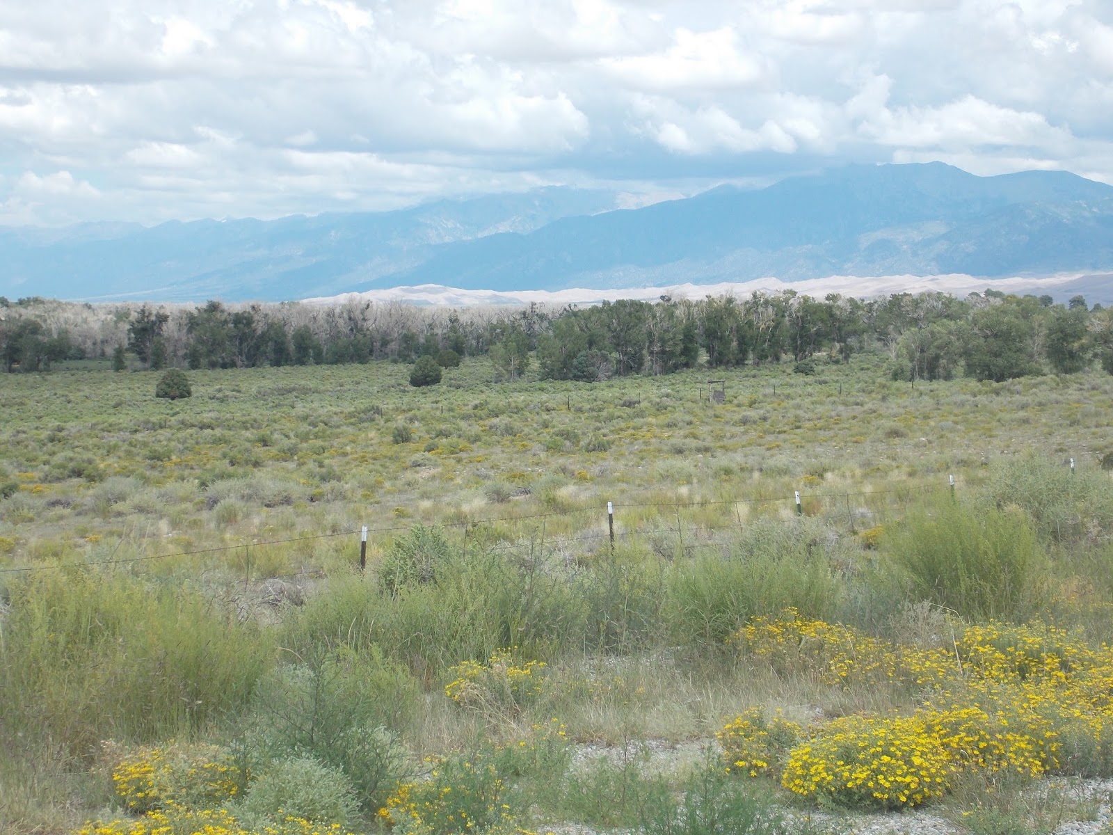
We have now moved from Colorado Springs to Alamosa, Colorado. We are still seeing mountains here in the San Luis Valley. San Juan Mountains and Continental Divide are to the West, and thirty miles south, beyond the San Juan Hills, is New Mexico. The Sangre de Cristo Mountains enclose the Valley to the East and north. They provide a dramatic back-drop to the Great Sand Dunes. In the picture below the dunes are the thin white strip below the mountains. In the foreground is a very arid valley.
Thirty square miles of the dunes stretch to the north, south and west. According to a park brochure, the dunes were formed thousands of years ago with sand and and sediment which washed down from both the San Juan as well as Sangre de Cristo mountain ranges. Prevailing southwesterly winds bounced the sand grains to pile them up beneath the Sangre de Cristo Mountains. Prevailing northeasterly winds through the mountain passes caused the sand to pile back up on themselves thus creating very large dunes. They are the largest in North America, some as high as 750 feet.
We hiked up to the nearest hill of dunes, it was a hard climb, and we felt it necessary to move fast as a storm was moving in. Climbing those hills was a lot harder than we had imagined, but it was fun running down-I did not care at all if I fell! Most fortunately it was overcast and cool. During the summer months the sand can be as hot as 150 degrees F.
It is necessary to cross a creek bed before climbing the dunes. Medano and Sand Creeks wrap their arms around the dunes. The creeks are fed by melting snow from the mountains during the spring months, which resupply the aquifers below the dunes. By August the creeks are just small puddles, as seen in the picture above. What is fascinating about the dunes is that they are constantly changing color due to the play of sun rays and shadows on them. While we were in the area we saw them change from brown to gray to pink and white. Clouds above us also were ever changing, from fluffy white to dark rain clouds. It never rained that hard on us, but off in the distance we could tell that the rain was pouring down.
One last item here. While hiking around the visitor's center I came upon the most exquisite plant with pale pink blooms on it. I learned from a park ranger that it is a desert verbena. According to him, what I thought of as flowers on it were instead the fruit or seeds of the plant.
Thirty square miles of the dunes stretch to the north, south and west. According to a park brochure, the dunes were formed thousands of years ago with sand and and sediment which washed down from both the San Juan as well as Sangre de Cristo mountain ranges. Prevailing southwesterly winds bounced the sand grains to pile them up beneath the Sangre de Cristo Mountains. Prevailing northeasterly winds through the mountain passes caused the sand to pile back up on themselves thus creating very large dunes. They are the largest in North America, some as high as 750 feet.
We hiked up to the nearest hill of dunes, it was a hard climb, and we felt it necessary to move fast as a storm was moving in. Climbing those hills was a lot harder than we had imagined, but it was fun running down-I did not care at all if I fell! Most fortunately it was overcast and cool. During the summer months the sand can be as hot as 150 degrees F.
One last item here. While hiking around the visitor's center I came upon the most exquisite plant with pale pink blooms on it. I learned from a park ranger that it is a desert verbena. According to him, what I thought of as flowers on it were instead the fruit or seeds of the plant.
Friday, July 31, 2015
Manitou Springs, Colorado
There is a lot of charm to be found in this older mountain town. It has preserved some of its older buildings and resorts. One such building is Miramont Castle, built in 1895 for Father Jean Baptiste Francolon and his mother. They were quite wealthy and had a chateau in France, which they returned to in 1900. The Father had been poisoned in New Mexico and had some lingering ill effects from that. He came to Manitou Springs with the hope that the Sisters of Mercy would care for him in his castle. He became the local parish priest. After he returned to France the Sister converted the building into a sanitarium.
What an impressive place this is, on many levels. It is built into a mountainside, has 30 rooms and 14,000 square feet. There are four flours stepped up the mountainside allowing for each floor to open onto the ground floor. There are 9 styles of architecture within the building, and unusually shaped rooms. One room, later converted by the Sisters into a chapel, has 8 sides, and a guest bedroom has 16.
Miramont means "mountain view", and the castle was built with that in mind. The room pictured above is the seven-sided glass solarium which has a roof with an 18" crown. It originally had a glass roof. The Sisters found this room to be ideal for minor surgical procedures. The castle also has a couple of interesting museums, one of which relates to Fire Departments and shows the advancement of their equipment over the years. A resident of the area, Judge John Carlton Young, was one of several judges who presided over the Nuremberg war trials. He brought back official trial photos which are on display in the castle. There is an art gallery in the great hall on the fourth floor. That floor has been used for local civic meetings, weddings, as well as for functions of the local Air Force Academy.
After touring the castle we decided to check out some of the other historic buildings of the town. Pictured above is the Cliff House built in 1874. By 1913 it was one of the largest and finest hotels in Manitou Springs with 265 rooms. After seeing some of the older buildings we decided to wander further through the downtown with its many unique galleries and shops. We also were aware that the town has 8 mineral springs. Native Indians were the first to come here for the natural soda springs which they thought has healing properties. We found a couple of the springs and tried the water which reminds me of a dilute, sweet alka-seltzer. It maintains a temperature of 49 to 55 degrees. Pictured below is Cheyenne Springs.
An interpretive sign there explains that in the stone building the water is temporarily separated from the carbon dioxide for sterilization. The water comes up from limestone aquifers a mile deep and is believed to be 20,000 years old. A bottling water plant started in 1892, bath houses were also begun in the town then. In the picture above, next to the building, is a bridge over a rushing mountain stream. Both Fountain Creek and William Canyon Creek play a role in aquifer recharge.
What an impressive place this is, on many levels. It is built into a mountainside, has 30 rooms and 14,000 square feet. There are four flours stepped up the mountainside allowing for each floor to open onto the ground floor. There are 9 styles of architecture within the building, and unusually shaped rooms. One room, later converted by the Sisters into a chapel, has 8 sides, and a guest bedroom has 16.
Miramont means "mountain view", and the castle was built with that in mind. The room pictured above is the seven-sided glass solarium which has a roof with an 18" crown. It originally had a glass roof. The Sisters found this room to be ideal for minor surgical procedures. The castle also has a couple of interesting museums, one of which relates to Fire Departments and shows the advancement of their equipment over the years. A resident of the area, Judge John Carlton Young, was one of several judges who presided over the Nuremberg war trials. He brought back official trial photos which are on display in the castle. There is an art gallery in the great hall on the fourth floor. That floor has been used for local civic meetings, weddings, as well as for functions of the local Air Force Academy.
After touring the castle we decided to check out some of the other historic buildings of the town. Pictured above is the Cliff House built in 1874. By 1913 it was one of the largest and finest hotels in Manitou Springs with 265 rooms. After seeing some of the older buildings we decided to wander further through the downtown with its many unique galleries and shops. We also were aware that the town has 8 mineral springs. Native Indians were the first to come here for the natural soda springs which they thought has healing properties. We found a couple of the springs and tried the water which reminds me of a dilute, sweet alka-seltzer. It maintains a temperature of 49 to 55 degrees. Pictured below is Cheyenne Springs.
An interpretive sign there explains that in the stone building the water is temporarily separated from the carbon dioxide for sterilization. The water comes up from limestone aquifers a mile deep and is believed to be 20,000 years old. A bottling water plant started in 1892, bath houses were also begun in the town then. In the picture above, next to the building, is a bridge over a rushing mountain stream. Both Fountain Creek and William Canyon Creek play a role in aquifer recharge.
Thursday, July 30, 2015
North Cheyenne Canon Park
Sometimes I wonder about my tour guide. John said we were going to see Seven Falls, but we ended up at North Cheyenne. They both can be reached by Cheyenne Blvd in Colorado Springs. Seven Falls is privately owned and requires an admission pass, whereas North Cheyenne is owned by the city and no fee is required for admission. So maybe on the way to Seven Falls he saw this other park and we happened to wander into it, I do not know. We had a beautiful drive through a canyon with striking rock formations, saw two tall tumbling falls and got a good hike in- I was satisfied and my tour guide redeemed himself!
The first falls are named after Helen Hunt, who came to Colorado Springs in 1873 because of ill health. She is the author of Ramona and A Century of Dishonor. She wrote of the beauties of Cheyenne Mountain. I will quote here a verse of the poem she wrote regarding the falls: "Here in these water slides of North Cheyenne Canyon you shall see in one small space water moving from side to side in a stately minuet motion over a many-colored surface of rock more beautiful that a mosaic".
From the lower falls we hiked to the upper one called Silver Cascade. Even though there was a trail it was a bit treacherous with lots of loose rock. Patches of wildflower made it all worthwhile.
John had noticed driving into the falls area a dirt road with caution signs. He inquired about it at the visitor's center and was assured that it was all right to take for our return trip to the city. My tour guide came through again, it was a bit of a scarey drive, but we saw some great scenery.
The road was mostly narrow, curvy and one lane with no guard rails. Fortunately there were few other cars on the road. No one had warned us either that there were two short tunnels to go through. Entering them we were not sure what was at the end of the tunnels. The beauty of the canyon was still worth it. Sometimes there were steep rock walls on either side of us, other places we could see large red rock formations in the distance. A very rugged land indeed with a beauty all of its own.
The first falls are named after Helen Hunt, who came to Colorado Springs in 1873 because of ill health. She is the author of Ramona and A Century of Dishonor. She wrote of the beauties of Cheyenne Mountain. I will quote here a verse of the poem she wrote regarding the falls: "Here in these water slides of North Cheyenne Canyon you shall see in one small space water moving from side to side in a stately minuet motion over a many-colored surface of rock more beautiful that a mosaic".
From the lower falls we hiked to the upper one called Silver Cascade. Even though there was a trail it was a bit treacherous with lots of loose rock. Patches of wildflower made it all worthwhile.
John had noticed driving into the falls area a dirt road with caution signs. He inquired about it at the visitor's center and was assured that it was all right to take for our return trip to the city. My tour guide came through again, it was a bit of a scarey drive, but we saw some great scenery.
The road was mostly narrow, curvy and one lane with no guard rails. Fortunately there were few other cars on the road. No one had warned us either that there were two short tunnels to go through. Entering them we were not sure what was at the end of the tunnels. The beauty of the canyon was still worth it. Sometimes there were steep rock walls on either side of us, other places we could see large red rock formations in the distance. A very rugged land indeed with a beauty all of its own.
Pike's Peak
We are still parked in Colorado Springs, probably leaving tomorrow. I was not too happy having to park within a bustling city, until I walked from our home to a nearby trail which runs along Fountain Creek. Before even leaving the rv park, a black squirrel ran across my path. They are rare, some towns we have been through have as their only claim to fame the presence of black squirrels. However, we never saw them in those towns. Funny that I found one here. As I then walked down the trail a mule deer and her baby stepped out from the brush along the creek and stared at me. A young man I met later made the comment that deer are more prevalent in this city than in all of Colorado! Finally I want to show the view of Pike's Peak which we have near our home. I am coming to like where we are parked.
The famous mountain top has the patch of snow on it. It was the first mountain peak in the Front Range of the Rockies seen by pioneers in their covered wagons after they had traveled the Great Plains. Soon the favorite phrase became "Pike's Peak or bust". Zebulon Pike and 28 other men, assigned by President Jefferson to investigate the boundaries of the Louisiana Purchase, tried to scale the mountain but did not make it because of inclement weather. However, Pike was the first one to write of it, and his name was then given to the peak. Kathleen Bates, a professor from Wellesley College, was lecturing at Colorado College in 1893. She joined an expedition to the summit of Pikes Peak. Thrilled with the beauty of what she saw there she wrote the poem which later became known as "America the Beautiful".
John and I took the cog railroad to the summit yesterday. In the mid 1880s Zalmon Simmons (founder of the mattress company by the same name) took a burro up the mountain and decided that there had to be an easier way to go for everyone to see the peak. Being an inventor, he liked the cog railroad system and began building it, and it was completed by 1891.
We have taken the railway before, but I am glad we did it again. Traveling up the steep grades of the mountain we saw tall forests of fir and aspen, as well as meadows of wildflowers. Coming down there were mule deer in those meadows. We also saw rushing mountain streams as well as large granite boulders along and in those streams. Shortly stepping off the train at the summit a herd of bighorn mountain sheep greeted us. I was able to capture a picture of one before they headed down. By the way, it was 47 degrees art the summit, with a wind chill of 41 degrees. After taking in the views at the top, a cup of hot cocoa tasted good!
One last photo here, that of a view of the Garden of the Gods in the foreground and Colorado Springs from the summit. In the other direction was the Continental Divide, under a bit of cloud cover.
The famous mountain top has the patch of snow on it. It was the first mountain peak in the Front Range of the Rockies seen by pioneers in their covered wagons after they had traveled the Great Plains. Soon the favorite phrase became "Pike's Peak or bust". Zebulon Pike and 28 other men, assigned by President Jefferson to investigate the boundaries of the Louisiana Purchase, tried to scale the mountain but did not make it because of inclement weather. However, Pike was the first one to write of it, and his name was then given to the peak. Kathleen Bates, a professor from Wellesley College, was lecturing at Colorado College in 1893. She joined an expedition to the summit of Pikes Peak. Thrilled with the beauty of what she saw there she wrote the poem which later became known as "America the Beautiful".
John and I took the cog railroad to the summit yesterday. In the mid 1880s Zalmon Simmons (founder of the mattress company by the same name) took a burro up the mountain and decided that there had to be an easier way to go for everyone to see the peak. Being an inventor, he liked the cog railroad system and began building it, and it was completed by 1891.
We have taken the railway before, but I am glad we did it again. Traveling up the steep grades of the mountain we saw tall forests of fir and aspen, as well as meadows of wildflowers. Coming down there were mule deer in those meadows. We also saw rushing mountain streams as well as large granite boulders along and in those streams. Shortly stepping off the train at the summit a herd of bighorn mountain sheep greeted us. I was able to capture a picture of one before they headed down. By the way, it was 47 degrees art the summit, with a wind chill of 41 degrees. After taking in the views at the top, a cup of hot cocoa tasted good!
One last photo here, that of a view of the Garden of the Gods in the foreground and Colorado Springs from the summit. In the other direction was the Continental Divide, under a bit of cloud cover.
Subscribe to:
Posts (Atom)