Saturday, October 26, 2013

Santa Ana Zoo

Who needs Disneyland when we can go to a zoo with 50 monkeys?  The Prentice Park Zoo was given to the city 60 years ago with the condition that it is to house 50 monkeys at all times.  That was the impetus for John and I to make certain that we stop at the zoo before leaving Santa Ana.
Pictured above is a cotton- top tamarin monkey, there are also other varieties of tamarins- as well as gibbons, capuchins and spider monkeys.  Speaking of the latter, we were intrigued watching them snack on their food.  They seemed to have a compulsion to wash their food in a tub of water before eating it.  We spent a great deal of time at the monkey cages, but the zoo does have other interesting animals as well as birds.  It seems that even in small zoos as this one we seem to find one animal which we do not remember seeing in other zoos.  This time we saw a binturong, a small mammal in the civet family which has the appearance of a cross between a cat and a bear.  I could not get a good picture of him.
 
I got excited when I saw the green-cheeked parrot, which is pictured above.  It looked like the ones we had seen Sunday while hiking in Irvine Park.  The zoo has a small collection of parrots which they have found injured in the surrounding towns of Irvine, Tustin, as well as Santa Ana.  Some of the wild parrots which are found in southern California were once caged birds.  The number of green-cheeked parrots were down to 3,000 because of poachers collecting them- that has changed since Mexico protected them with their  Endangered Species law.
To some extent the zoo is also a botanical garden, it has many tropical plants and trees which are labeled.  Pictured above is the silk floss tree which is currently blossoming.  In its seed pod are white cotton- like fibers which are attached to black seeds.  Before the advent of synthetic materials, the fibers were used to stuff pillows.  The beautiful flower with its seed pod is pictured below.  We have learned in our travels to never pass up a zoo, no matter how small it is.  About every time we visit one we are glad we stopped- and the Prentice Park Zoo was no exception.


Friday, October 25, 2013

Santa Ana, California

John and I have enjoyed exploring some of the little Californian towns which surround Anaheim.  Yesterday we drove to Santa Ana, Orange County's county seat.  The town began in 1869 when a man purchased 70 acres of Rancho Santiago de Santa Ana, abbreviated the name and plotted out a townsite.  He persuaded Los Angeles-Santiago line to stop in Santa Ana and the town grew, especially so when the Sante
Fe Railroad later came into the town in 1887.  Two years later Orange County split off from Los Angeles and named Santa Ana as the county seat.  A granite and sandstone Romanesque style courthouse was built  in 1901 when Santa Ana was still a farm town.  The courthouse survived an earthquake in 1933.
The building was restored from 1983-1992.  Over the years it has been the scene of several important and far-reaching court cases.  It is a favorite movie location also, six of them to be exact- Catch Me If You Can with Leonardo DiCaprio was a recent one shot there.  Today the courthouse is the place to get your marriage license and ceremony if need be.  It houses other governmental offices as well as the Orange County History Center.  Santa Ana has preserved more of its architectural past than the rest of the county combined.  In the 36 blocks of its historic district are a variety of architectural styles.
The Victorian home above is now home to Citibank, pictured above.  Another interesting building which caught my eye is the Sartora Arts Building.  It has been the heart of the Artists Village area for years.
The 1928 building was the home of Daninger's Tea Room in the 1930s and 1940s.  The restaurant reportedly attracted many Hollywood celebrities.  Most fortunately, a lady saw me taking pictures of the building and directed me to a shop which had the Santa Ana Register.  In the current issue there is an article on the history of the building.  It has recently been in the news because a new owner now has keys to the building.


Wednesday, October 23, 2013

San Juan Capistrano


Last time we visited the Mission of San Juan Capistrano it was before the swallows came (that day being March 19), this time it was shortly after they have left.  However, we did see in the eaves of the mission their gourd-shaped nests made of mud pellets.  And we saw many monarch butterflies and hummingbirds.  It was not a surprise to see them hanging around the place, what with the lavish gardens and fountains which are everywhere on the Mission’s grounds.  It is a beautiful place with adobe buildings and brick pathways!
 
I am glad we made a return visit to San Juan Capistrano as there is so much rich history within its walls.  Established in 1776 by the Spanish, this was the beginning of Orange County.  Secularization of the California missions happened in the 1830s.  The mission territory was then distributed among 20 California families, as well as Native Americans who had lived at the Mission.  President Lincoln restored the mission to the church several years before his death.  On our previous trip to the mission I do not believe we had the audio tour listening device, having it this time certainly enhanced our visit.  Besides explaining the different buildings and ruins of  the mission, the audio had personal stories to tell- as that of a child's memory of the celebration of the return of the swallows, and a priest's recall of saying mass while chickens walked by the altar.  We started our visit at Mission Basilica San Juan Capistrano, which is located near the old mission.  Built in 1986, it was designed after the Great Stone Church which was destroyed by an earthquake in 1812. 
 The ruins of the original church, built in the late 1800s, are still on the grounds of the mission today.  The original bells of that church mark the spot where the bell tower of that church use to stand.  With only a portion of the stone chuch surviving, it was not possible to build a complete replica.
 
 After touring the mission we walked around the town of San Juan Capistrano.  It is set in rolling hills between the Santa Ana Mountains and the sea.  The town has many older adobe buildings, as the one pictured below.  The house was built in 1794 and is in the process of restoration.  The 1895 Sante Fe Railroad is now being used by Amtrak for a terminal and also serves as a restaurant.


Sunday, October 20, 2013

Fullerton Arboretum


We have had many sunny days since we arrived in southern California this past week.  And I believe that it was on Wednesday when we were the hottest place in the nation!  I made the comment to John that I would appreciate one cloudy cool day for a change of pace.  The arboretum we visited yesterday is on the campus of the California State University-Fullerton campus.  It is a 26-acre botanical garden with plants from around the world and the location of the first commercial citrus grove in Orange County.  Oddly enough, the first picture I took here was that of a piece of artwork.  For the month of October there is the "Green Dress Project" being displayed in the arboretum.  With her dresses made of all natural materials,  environmental artist, Nicole Dextras demonstarates that “our future depends on the creation of garments made from sustainable resources”.
The gardens have a small redwood forest, as well as a deciduous forest.    In the gardens are also a variety of ficus, or fig trees. One is the Sacred Fig, or the Bodhi Tree, also known as the Tree of Knowledge or Enlightenment.  It was planted in celebration of 14th Dalai Lama's visit to the campus in  2000.  Another fig tree had fruit on it, and an interpretive sign near it provided information as to how the tree is pollinated.  A fig wasp enters a female flower and, after pollinating it, lays her eggs to ensure that there will be another generation of wasps.  Another ficus tree, the banyon, is pictured below.  It has aerial roots which form branches to the earth below.  In some parts of the world they are called “walking trees”.  In Hawaii a few years back we saw a whole city block covered by the branches of one banyon tree.
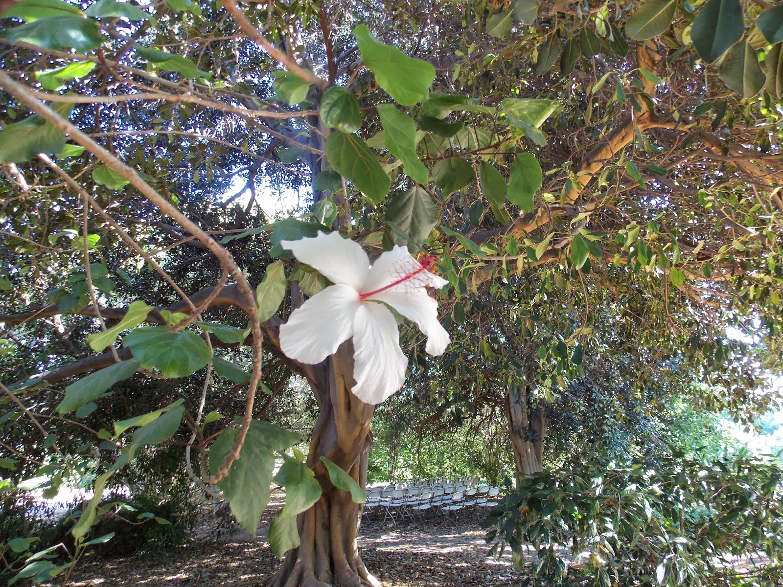
I think that it was in this area we found several trees with what looked like hibiscus flowers on them, one of which is pictured below.  The other two trees had red and yellow blooms.  Unfortunately the arboretum has not labeled all the plants.  I am not so inclined anymore in asking people for help in identifying plants, as there few people (even locals who should know them) who can help me in that regard.
 Another very interesting part of the arboretum is the cactus section.  I thought that I was familiar with many cactus plants, but here I found many unusual ones.  And in another section are vegetable and rose gardens.  One squirrel caught my eye there because it appeared that he was munching on straw.  However, turns out that he was dining on pumpkins seeds,  he was totally oblivious to any humans around him!

Thursday, October 17, 2013

Orange County, California

We left Bakersfield on Tuesday, heading south on Interstate I- 5.  On that busy eight- lane highway we had one mountain range to chug over.  Our rig does not do well climbing mountains and quite often we ended up behind large trucks in the slow lane.  But that was all right because it gave us more time to enjoy the mountain vistas, as the one pictured below.  It is Pyramid Lake in the Angeles and Los Padres National Forest.
We are now parked in Orange, near Anaheim- well-known for being home to the original Disneyland Park.  Orange County's oldest city's name, Anaheim, is a blend of "Ana" after the Santa Ana River and "heim" a common German name meaning "home".  At one time orange groves were plentiful in this area.  The park we are currently residing in was once an orange grove.  Next to our rig on one side is a grapefruit tree, and on the other are two orange trees.  Unfortunately the fruit is not ripe yet for picking.  And speaking of oranges, we toured the town of Orange yesterday.  It is located across the Santa Ana River from Anaheim.  Old Town Orange has a one-mile square area that is centered around the historic Orange Plaza, pictured below.
In this older area of Orange are buildings dating back to the late 19th century and early twentieth century.  Watson Drug and Soda Fountain, still in business, dates back to 1899.  We also walked by many specialty stores, as well as boutiques and restaurants.  Orange City is also considered the antique capital of California.  We walked through one antique shop which also has a garden and nursery in the back.
In this store, Country Road Antiques, the nursery has weird and unusual plants sitting in stoves, refrigerators and even an old Ford truck.  I would have liked to have stayed longer and maybe even purchased one of the plants, however we got there shortly before the store's closing time.  After supper we joined a crowd gathered at the plaza.  I was told by one of the other on-lookers that the veterans get together here every Wednesday evening.  On this  particular evening seven veterans were present from World War II.  After a few short speeches the national anthem was sung and a young man played "Taps" on his trumpet.


Monday, October 14, 2013

Weedpatch, California

We have found plenty to do in Bakersfield, despite the fact that we were here in 2012.  Saturday we frove to Tehachapi for an apple festival.  On the way we stopped on a hill overlooking the Tehachapi Railroad, considered one of the seven wonders of the railroad world.
This railroad line was constructed by 3,000 Chinese laborers from 1874-1875.  They dug through solid and decomposed granite to build 18 tunnels, and 10 bridges for the railroad to pass over and through the hills pictured above.  It was the last and final link which connected San Francisco and Los Angeles, and remains in continuous use still today.  A fascinating feature of this railroad line is a loop which enables the last car of an 85-car train to pass above the engine in the tunnel below. 
Fast forward fifty-five years later and there is another group of laborers in our country's history who deserve some mention- they were immortalized in John Steinbeck's Grapes of Wrath.  The migrant workers fleeing the Oklahoma Dust Bowl during the Great Depression were looking forward to a better life in California.  The federal government supplied tin structures and tents for them to live in as they worked in the agricultural fields of San Joaquin.  Unfortunately they were looked down on by the local people and given the derogatory name of "Okies".   Today there is still Federal housing at Weedpatch for migrant workers, however the older buildings have been replaced by wooden structures.  Before driving to Weedpatch (which is 10 miles southeast of Bakersfield) we stopped at California State University to look at the exhibit which just opened there on the Dust Bowl Era.  It has been provided by the Steinbeck Center and is a re-enactment of the fictional Joad's journey to California.  Pictures of the migrant workers and their hardscrabble life in Weedpatch (also known as Sunset Labor Camp) were taken by Dorothea Lange who, as well as  Steinbeck, visited the migrant camps at different times.  The photographs made the story told by Steinbeck so much more real to me and I am anxious to read the novel again.  It is the 75th anniversary of John Steinbeck's Grapes of Wrath.


Saturday, October 12, 2013

Southern San Joaquin Valley

We drove southwest from Bakersfield today, and our first stop was at the Tule Elk State Park.
Two years ago when we visited this park we did not see any elk.  Today there were four male hanging out near the visitor's viewing area, and a larger number of the female.  There are three different subspecies of elk in the United States, the elk in this preserve are the smallest of them.  The Tule elk once dominated the deer and pronghorn population in the San Joaquin Valley.  Before and after the Gold Rush years they were hunted to almost extinction until a cattle rancher set aside 600 acres of open range for the elk (today's preserve).  A 1895 count showed 28 surviving tule elk.  Whenever the herd here exceeds 30-35 they are relocated to other open spaces.
After leaving the preserve we drove by large fields of cotton.  Fortunately the crop was being harvested today.  We watched as a green cotton picker moved slowly down the aisles of cotton and pulled the cotton off the plants.  Once the bins on those machines were filled, the picked cotton was dumped into the red container pictured above, and packed down.  Large bound bales of  cotton stood nearby ready to be trucked out and sent to market.  Our drive next took us to large oil fields.
Kern County is home to some of the richest oilfields in the world.  We stopped to see the historic site of the Lakeview Gusher.  Over 18 months between 1910 and 1911 it flowed uncapped and untamed at 18,000 barrels a day.  Now all that remains of that gusher is an oil-stained crater in the earth.
Our last stop of the day was at the Wind Wolves Preserve, at 95,000 acres it is the west coast's largest non-profit preserve.  In this park five mountain ranges converge, it has elevations from 640 to 6,005 feet. Tule elk herd here has grown to 200.  Currently the U.S. Fish and Wildlife Service is placing stillborn calves of the elk on the preserve for the California Condor, which can be seen in the higher elevations.  We took a short hike into the preserve, along our way we found an historical marker which noted that the road pictured above was once El Camino Viejo- or "The Old Road", the original inland route to San Francisco Bay from El Pueblo de Los Angeles.  Our hike took us through the San Joaquin valley floor, a veritable sea of grasslands surrounded us.  A creek runs through the park and provides riparian wetlands.


Friday, October 11, 2013

Bakersfield, California

We have moved to Bakersfield, as you may notice from the above picture.  Most of the little towns in this area use to have similar welcome signs.  Bakersfield original sign has been long gone, however Buck Owens (country singer) rebuilt it using the original letters.  It is located near his music hall and restaurant, which we revisited the first day we got here.
The town is proud of its many sunny days.  Wednesday was a different story.  A gusty wind blew a lot of dust into the air which caused the brownish grey coloring of skies.  The area has not had rain for about 156 days and it is very much needed.  What came down on Wednesday was not an appreciable amount and only created mud.  The sun came out on Thursday and, as the weather man noted, no more rain was in the forecast- it was a car wash day.  We chose instead to ignore the mud on our car and went on a road trip.
We drove north out of Bakersfield on the Kern River Scenic Highway, through Kern Canyon.   Our drive took us past Lake Isabella, which currently is not much more than a mudhole.  A local commented to us that she has never seen the water level that low.  Our drive ended at the Audubon Kern River Perserve.  This park is managed by Audubon-California for the preservation of California's contiguous Valley Cottonwood-Willow Riparian Forest and the wildlife it supports.  By the way, we learned from the park's brochure that willow bark is the natural source of aspirin. The nature preserve lies along the South of the Kern River, which is currently dry.  On our hike through the forest we saw a variety of finches, sparrows and heard woodpeckers.  Only wildlife we could see well enough to identify was a covey of California quail.  Despite the lack of wildlife it was a beautiful walk, what with the pretty blue sky, and brilliant yellow of the blooming rabbit bush.  High up in some of the trees we could also spot the bright green color of clumps of mistletoe.


Wednesday, October 9, 2013

Fresno's 130th Fair


             Our WI-FI connection here where we are now parked is quite weak, so I will not use pictures in this posting.  Despite Yosemite being closed, we still had a good stay in Chowchilla.  Saturday we drove north to the Sierra National Forest, to an area of the forest called Nelder Grove.  It is on private land so it has not closed.  The grove consists of about 1,540 acres.  Currently there are about 100 mature sequoias mixed in a forest of pine, cedar and fir.  From 1888 to the 1920 two hundred and seventy seven mature giant sequoias were harvested.  John and I hiked on trails which led us to the Bull Buck Tree, and Big Ed.  During the logging in the 1800s the felling foreman or wood boss told his crew to preserve the former tree for prosperity.  Because of its size the Bull Buck Tree was made the boss of the woods.  It is about 2,700 years old, 250 feet tall and 100 feet around the base.  It, as well as Mr. Ed, is a very beautiful, healthy sequoia. 

           Sunday we attended a Lutheran church in Chowchilla, and were invited to a dinner which they had after the service.  I am glad we took them up on their invitation because while mingling with the members before the meal we met an almond grower, as well as a young lady who is in marketing for a dried fruit company.  We learned more about almond growing, as well as pistachio and raisin harvesting.  One man, who works for a company which makes pallets, said that his company makes a large number of wooden boxes for bee hives.  Bees are needed in this area for the pollination of the almond trees. 

         At the Fresno Fair we saw the fruits, nuts, and vegetables produced by the San Joquin Valley.  We had never before seen such a large display grapes and raisins!  No wonder, there are 100 different varieties of grapes grown in Fresno County.  Sun Maid had a display, it has 750 grower farms.   Other produce of the area was also on display- besides almonds and pistachios, there were peanuts, cotton, prickly pear and garlic.  Peaches are now out of season, but some were on display- as well as pears, plums and apples and a wide variety of citrus fruit.  There are 250 different crops grown in the valley area.  We visited other exhibit halls, my favorites were the fine arts and home arts.   In the latter we saw products made from wood, also quilts, and decorated Christmas trees, as well as unique table settings.  In the Green Hall, we saw a wide variety of African violets, bonsai, orchids and roses as well as other plants and flowers.  Also on display were charming garden settings.

         We also saw several shows at the fair.   A first for us was “Mutton Bustin”.   In this show children age 4years to 7 ride sheep- at the end of the fair a final competition is held to determine who gets the grand prize of $5,000 dollars.  It takes a pretty gutsy young child to enter this contest- it seemed to be a difficult feat for them to hold onto the wool of a racing sheep!   Each rider does wear a helmet, and many people are standing nearby to grab them if they get into an unsafe situation.  I felt that we had experienced so many new things at the Fresno Fair- maybe my supper should also be a first time event.  I ordered a lobster corn dog with lemon aioli sauce.  Delicious, just about like eating fish with hush puppies! 

          After supper we attended a Neil Sedaka concert in the large outdoor arena on the fairgrounds.  He sang many of his older songs from the 1960s, as well as some of his newer ones.  Over his fifty some years of singing Neil Sedaka claimed that he has written 800 songs.   It was a great concert, also enhanced by a female vocalist, sax and piano players.  All right, I have to admit it was not for the younger crowd!  In summary I only have to say that if you ever have an opportunity to attend the Fresno Fair, don’t miss it!

Monday, October 7, 2013

Fresno, California


Fresno, California is about 30 miles south of where we are now parked.  Yesterday we drove there to tour the Forestiere Underground Gardens, as well as the Fresno zoo.  We certainly had a full and wonderful day seeing those tourist attractions!  Other than several museums there is not much else to be found in Fresno.  Driving around the town we discovered that there are no outstanding historical or downtown areas to explore.  There is a fair going on, which we plan to attend Monday.  Baldasare Forestiere (1879-1946) built his home and gardens over 38 years.  As a young Italian he came to the United States in the early 1900s.  At first he was a subway digger in Boston.  However, he was more use to the Mediterranean climate, so he moved to California where he found the San Joaquin Valley more to his liking.  Soon after he arrived in the valley there was a heat wave with temperatures up to 105 degrees.  He also discovered that the soil, called hardpan, was too hard to plant citrus groves.  Quite literally he started digging underground to find cooler temperatures and a place to plant his trees.  He kept his day job as a ditch digger.  His home, over the years, became a complex of underground rooms, passages and gardens spread over a ten acre parcel of land..  He is quoted as saying:”the visions in my mind overwhelm me”.  Near his home in Italy were catacombs, and, he designed his home with them in mind.  We had a guided tour of the home and our first stop was the Trinity Courtyard, where Forestiere acknowledged the spiritual side of his personality.

In this courtyard there is one main planter with three wings.  Planted in them are three trees and, also three benches.  Also planted in this area is a grapevine which Foresteir pruned so that the vine would come out of the wall in three places.  An interpretive sign explained that Forestiere pruned the grape vine in that manner to once again keep in mind the “quiet trinity”.   As you may deduce, Foresteire was a horticulturist- in his planters he had oranges, lemons, grapefruit (even multiple varieties grafted onto a single tree) as well as other varieties as kumquat, loquat, jujube, strawberry, quince and dates.  When we walked through the home many of the plants were loaded with fruit.  Grapes are hanging off the vine under the oranges in the picture below.
In the home there is a kitchen complete with a stove, icebox and cupboards.  Off from the kitchen he had two bedrooms, one for the winter and the other for the summer months.  Unlike the winter room which had his bed placed by the window, his summer bedroom had the bed placed in the room’s cooler interior.  That room is pictured below, notice the trees which he hand-painted on the pillars.

In one of the courtyards is a large Victorian bathtub. The house also has a fishing pond as well as an aquarium and chapel.  The owner also had it wired for electricity.  After Foresteir died his family came from Italy to decide what to do with the home.  Fortunately one of his brothers bought it, and his descendents have kept it going since.  After the tour we spent some time in the gardens outside.  Pictured below is a pomegranate tree loaded with fruit.  A blooming rose bush sits below the tree.


Friday, October 4, 2013

Chowchilla, California

We have moved to the San Joaquin Valley of California.  It is very dry here, whatever we find green  is because of irrigation.   Our plan was to visit Yosemite National Park.  Being a national park, it is currently closed, thanks to the intelligent representatives and senators whom we voted into office.  Our issue of not being able to see Yosemite, however, is minor compared to the situation of thousands of federal employees who are out of work and are not even going to receive a paycheck for their days off.  Anyway, it is what it is, we will be here for a week and then will move on.  There are still things for us to do in the area.  The town of Chowchilla has a population of 17,00.  It seems to spill out into the countryside where there are large ochards of pistachios and almonds.
What may look like rocks on the ground in the picture above are almonds, which are being harvested now.  John and I watched a small red truck go up and down the aisles sweeping the nuts  into a bin attached to the vehicle.   We also tried a couple of the nuts, they were delicious, with a hint of a vanilla flavor.
Perhaps you are wondering why we drove out into the country to watch almonds being harvested.  Actually, across from the orchard is the Fossil Discovery Center.  It is one of the largest fossil sites in our nation.  In 1993 a landfill worker saw something unusual in the clay ground.  There, 35 feet below ground, was a tusk from a mammoth that had been washed up in an old river channel 500,000 years ago.  Further diggings have revealed bones of other animals from the Middle Pleistocene Epoch.  Besides the Columbian Mammoth, there are the fossils of a Saber-tooth cat, Dire wolf, ground sloth, and short faced bear. Replicas of the animals are in the fossil museum.  Pictured below is the skeleton of the bear.  Standing at 12 feet tall, he is believed to be one of the largest bears that ever lived.  He also had longer legs and a shorter snout than modern bears.
In the museum is also a display pertinent to the Native Americans of the region.  I an always amazed at the origin of state and city names in our country.  In this area lived the Yokuts, and  the Chowchillas(Chauchila) were part of that tribe.   By talking to another visitor to the museum we discovered that we were not too far from the Valley Pistachio Country Store.  Upon arriving at the nut store we discovered there was a winery next door.  The CRU company is one of about 12 wineries on the Madera Trail.  If all else fails and we have nothing to do while in Chowchilla, we will at least have wineries to visit!

Monday, September 30, 2013

Malakoff Diggins State Historic Park

I did not do justice to the city of Auburn in my last posting.  It is one of the few mining towns which has thrived and prospered, even after the gold rush days ended. The town has had several fires over the years, but it has manged to keep and restore some of its historic buildings, one of which is a Victorian firehouse.

We enjoyed walking in the older section of town which has many quaint shops and art galleries. Restored old town has buildings from the mid-19th century. Another reason for the town's success is that in 1851 it became the Placer County seat.  The courthouse, built in 1894, is pictured below.  It is a rather impressive building and towers over the historic section of Auburn.

Over this past week-end John and I visited his cousin Christine and her husband Bill in Nevada City.  With them we attended the Grass Valley Celtic Festival on Saturday.  Irish tunes were played fairly continuously on a couple of stages.  We especially enjoyed Molley's Revenge and 1916.  On Sunday we left our wonderful hosts and drove to Malakoff Diggins.  John was interested in the hydraulic method of mining gold.  As I mentioned in a previous posting, placer gold ore was difficult to mine and, in the long run, not very profitable.  Toward the end of 1860 large-scale hydraulic mining began.  That particular type of mining involves blasting at mountains with powerful water cannons- to wash the ore free and uncover the gold-laden ore quartz underneath.  One mining company mined $3 million in gold leaves, but their expenditure was $3 million for capital improvements.  Unfortunately, farm lands and whole towns were consequently flooded when the resulting tailings began to build up.  Lives were lost.  Appeals were made to the State Legislature, and, by 1884, restrictions were placed on the mining companies.  They could no longer dump the tailings in the surrounding rivers, and it was no longer profittable to continue hydraulic mining.  In the park we saw the gouged hillsides which stand next to a massive pit.  There are now 3,200 acres of second-growth forests comprising of pines, cedars, oaks and firs growing in the upper slopes.  We hiked along the edge of the pit where manzanita bushes are growing profusely.  Despite the beauty of the trees and plants growing back, the gouged hillsides still speak to the expensive price for retriving gold by hydraulic mining.  It was truly a rape of the land.

Auburn and Coloma, California


On our way home from Lake Tahoe we stopped in Coloma, California.  The American River flows through Coloma, and the river is where the California gold rush began.  There are a few businesses left in the town, Marshall Gold Discovery State Historic Park encompasses most of it.
                                   
 It was January of 1848 when John Marshall discovered a few flecks of gold in the tailrace of the saw mill which he and John Sutter owned.  Word soon got out about the gold in the American River and young men from all over our nation came in droves to California.  We took a tour of the park with a docent who had lots of information to share with us about life in the town of Colona during the early years of the gold rush.  The lure of gold also drew people from China.  Still standing in the park are two buildings where the Chinese citizens of the town could purchase needed items from their home country.  The Man Lee was a trading, banking, and hardware store.  The other store, pictured below is the Wah Hop.  In the latter building has been placed merchandise which use to be sold in it.
 Some of the tour was a bit boring for me, especially when our guide discussed the various methods by which gold is mined.  Different mining equipment is located in the park, and that was part of our tour.  We learned how placer gold ore is mined by either a wet or a dry method.  Initially miners simply used a pan to separate the river gravel from the gold.  That proved to be a slow arduous process and many of the young men who traveled to California with hopes of getting rich never achieved the wealth they dreamed of.  Today people still pan for gold in the American River, and some are successful.  Our guide purchased a nugget from a person who found gold in the river several years ago.  He claims that the value of the nugget is around $4,000.00.  That was the most interesting part of the tour for me, to see that piece of gold!
From Coloma we drove to Auburn, where our home is currently parked.   Auburn is another historic gold mining town, founded in 1849.  At the Native Son Park, which we discovered while wandering around in the older section of town, we found a plaque honoring Claude Chana who found gold in the North Fork of the American river in May of 1848.  He camped in what would later be known as the Auburn Ravine.  
There is also another marker in the park which honors “all the Gold Miners throughout the Mother Lode”.  The memorial concludes with the comment that without the ingenuity and perseverance of the miners, California would not have become the “Golden State”.


Friday, September 27, 2013

Lake Tahoe


 On Tuesday we moved from the western part of the state to the eastern foothills of the Sierra Nevada mountain range, which is about in the central part of California.  One of our goals while here has been to visit Lake Tahoe.  We took a two day car trip to visit that area on Wednesday. 
 A cool front came in Monday from the coast, so I guess we should have realized that there was going to be a change in the temperature, especially around Lake Tahoe which has an elevation of 6,000 feet.  It is hard to believe from the picture above, but our first day at the lake had periods of grey clouds overhead with occasional brief snow showers.  Actually, we were not sure whether to even call it snow, but it was not rain.  It can only be described as small pieces of ice which melted as soon as they hit the ground.  After each brief spitting of ice the sun would come out again.  Our trip the first day took us by Donner Memorial State Park..  We stopped there to view the memorial dedicated to the ill-fated Donner Party, 36 of whose members died in the Sierra Nevada Mountains when trapped by a snowstorm in 1846.  Our other stop for the day was at Vikingsholm, a Scandinavian stone castle built in 1929 by Mrs. Lora J.Knight.  The only way to reach the home is either by boat or by hiking about one mile down a steep mountain slope.  We chose the latter, and the walking path led us to the back door of Vikingsholm.  The front part of the house, facing the lake, is pictured below.
We found the history of this home to be quite fascinating.  Mrs. Knight's second husband came from Ladue, Missouri.  While in St.Louis she met Charles Lindbergh, who, a few years later, flew her over Lake Tahoe to assist her in finding a site for her home.  She chose Emerald Bay on the lake because the setting reminded her of  the fjords she had seen in Norway.  She fell in love with  the rugged mountains, waterfalls which cascaded down granite cliffs, and the tiny island in the bay.   On this island she had built a small tea house.                    
                                    
The house has many Scandinavian features, which can be seen in the picture below.  In the cozy living room are two intricately carved “dragon” beams which hang from the ceiling.  A corner fireplace is present in the room, which is characteristic of Scandinavian architecture.  Also in the room is a brightly painted bride’s table, a piece given to a Swedish peasant girl customarily by her parents at the time of her marriage.  A peasant's chair sits in front of the table
 A craftsman, of Scandinavian descent, was responsible for the elaborate wood carvings around the doors and the dragons on the roof's peaks.  Another interesting feature of the stone castle is the sod roof which covers the north and south wings of the courtyard.  Mrs. Knight did not keep a goat on the roof, but yearly had native wildflowers planted on the sod roof when she came to stay for the summer.  After leaving Emerald Bay we drove down into South Tahoe city for the night.  On that drive we came over a very narrow ridge where a beautiful vista of mountains and lakes opened up before us.  Tahoe Lake was off to our left and also in front of us, and Crystal Lake was off to our right.  The sun shone brightly over the mountains in the distance.  The road was quite narrow here, with no guard rails- John described it as "white-knuckle driving", but I sure enjoyed the view!

Sunday, September 22, 2013

Muir Woods National Monument

As I had written previously, our home is now parked across the San Francisco Bay north of the city itself.  This has proven to be a good place to park as it has given us a different experience from the other times when we have visited this area.  Here we are surrounded by the Marion Headlands, or coastal hills.  Grassy hills slope down to valleys which sit next to the shoreline, we find it to be a very beautiful area even though we are still dealing with the hectic pace of city life.
One of the larger hills, which we can see from our home, is Mount Tamalpais.  Friday we drove over to the state park of the same name, where Muir Woods is located.  The coastal redwoods in this park are the tallest trees in the world, their height may be up to 368 feet and diameter of 20 feet.  Looking up into the canopy of this forest I could not help but be filled with awe at their majestic height.
The coastal redwoods are closely related to the giant sequoia and dawn redwood.  There use to be 40 of the species which once lived in a warmer, wetter climate- now there are 15 of the "ancient relics" remaining, most of them living around the Pacific Rim.  The trees in this park draw people from around the world.  We were there on a weekday, it was a bit cool and wet.  However, nothing seemed to deter the crowds of people who were there, a parking space was difficult to find and about 6 large tour buses came and left during the time we were there.  
                                 
Pictured above is a section of the woods called Cathedral Grove.  Here there are many signs encouraging the visitor to walk quietly through the cluster of trees.  There is also an brass plaque along the trail  commemorating a time in 1945 when world leaders came here after meeting in San Francisco to establish the United Nations.  They visited the woods to honor President Franklin Roosevelt who had died a month earlier.  Organizers of the event hoped "that the profound beauty and serenity of Muir Woods would inspire the delegates to pursue the President's program for world peace as they met to establish the United Nations".  Quotation was taken from the memorial plaque in the woods, which marks the spot where the world leaders stood on May 19, 1945.